The week ahead
Outlook summary
Overview Next week will start unsettled and wet for all areas and very windy for the northwest with a risk for gales. Later the north will see some dry weather, but also rather cool temperatures. Sharp nightime frost likely. The south will turn wet around mid-week and eastern areas will feel some cool North Sea winds.
Sunday. A deep Atlantic low will bring strong winds, rain and showers, wintry over higher grounds, to the northern UK and Ireland, while the southern UK will see some mild and relatively pleasant weather with sunny spells. Monday and Tuesday will be rather wet for all areas, with rain and wintry showers over the north and outbreaks of rain over the south as mild southwesterly air clashes with cooler northerly air - right above southern Britain.
 Mid-week a high pressure ridge will build up over northern Britain keeping northern areas mainly dry with sunny spells for a while. Scattered, however beefy cold showers possible. Temperatures rather cool, but feeling warm where the relatively strong March sun is coming out. Clear nighttime spells will trigger some sharp frost over the north. Rain over the south will slowly clear, as new rain will enter from northwest towards the end of the week. Temperatures around normal.
For further information check our regional 10-day outlook.
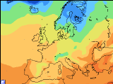
Forecast valid for Sunday, March 10th to Saturday, March 16th.