The Month Ahead
30 Day Outlook
 High pressure dominant, but low pressure nudging in at times
Anticyclonic influences have been dominant having played a controlling role in the weather pattern across the UK and Ireland for many weeks.
Whilst high pressure influences will continue through the short term, as we indicated during the last forecast, the hints are definitely there now that the middle of March will be more mixed.
A good old tussle may develop this week between cold air to the east and warm air to the west. During the middle of March high pressure is expected to decline away or shift to the east of Europe with the "block" of high pressure finally collapsing.
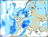
Low pressure will break through the UK and Ireland, but at the moment the movement and track of this low pressure is debatable. Conditions will become more changeable and unsettled through all areas, the main concentration possibly in the north, but the south too will see mixed weather.
Later in the month drier weather is expected again as high pressure once again tries or attempts to re-establish through the UK and Ireland. A more westerly end to the month.
April may see high pressure to the south at first but then turning more mixed.
 Updated Monday 8th March 2004. Valid Tuesday 9th March 2004 to Wednesday 7th April 2004.
Issued by Weather Consultancy Services Ltd in cooperation with WeatherOnline Ltd.
Subscribe for a detailed week to week forecast of the month ahead! Inquire terms and conditions here!
Compare with past Marches
Average Temperature
Average Frost Days
Average Days with Precipitation