The Month Ahead
30 Day Outlook September
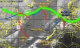 Changeable, but some finer spells
With the hurricane season well underway, any reliance on the global forecasting models will have to be treated with caution. This does not bode well for justifying our forecast, so confidence will have to be pitched rather low with this in mind.
Overall the pattern remains very fluid with the wide variation in what the flow may be during the coming month.
However, it does seem likely that the trend for a changeable type of flow remains evident. High pressure will often ridge or build into the UK on occasion, but its effect will often be transient, and the dominant effects will be felt across England and Wales.
The north of the UK will also see drier, brighter and warmer weather, but this will be interspersed by wet and often windy weather. The more unsettled conditions will push south through the remainder of the UK and Ireland, but should weaken as they move southward.
The best chance for any countrywide settled weather may be mid-month, although indications are that this too will be short-lived, as the prediction is that on current evidence September may end wet and windy as disturbed weather takes hold.
 Updated Monday 30th August 2004. Valid Tuesday 31st August 2004 to Wednesday 29th September 2004.
Issued by Weather Consultancy Services Ltd in cooperation with WeatherOnline Ltd.
Subscribe for a detailed week to week forecast of the month ahead! Inquire terms and conditions here!
Compare with past Augusts
Average Temperature
Average Frost Days
Average Days with Precipitation