Famous For One Day
'European' Hurricane Vince
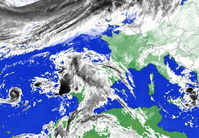
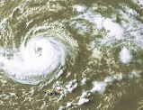 Sometimes small things do matter. Hurricane Vince became the 20th named storm of a hyperactive 2005 Atlantic Hurricane season, churning northeastward early Monday in the Atlantic near Portugal's Madeira Islands.
The tropical storm reached hurricane class 1 by Sunday night. This made him representing a very, very rare species: a true Hurricane heading for Europe. The visible satellite image is clearly showing rotational cloud bands around the storm's center affecting Madeira.
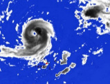 However, after being a meteorological celebrity for 12 hours, Vince has weakened to a tropical storm again and will probably fall apart before threatening any land. At 0900 GMT the storm was centered some 145 miles (235 kilometers) north of the Madeira islands.
The storm was moving east-northeast at about 12 miles per hour, with maximum sustained wind speeds of 65 mph (120 km/h), but is expected to weaken Monday. Vince is the 11th Atlantic storm to attain hurricane status so far this year.