Get set for a chill
Winter returns
Visit www.weatheronline.co.uk - the UK's most comprehensive internet weather - talk live to our forecasters for the latest forecast and weather news. Call 09061 991 189 (�1.50p/min)
Issued: 0900hrs Tuesday 5th April 2005
Duty forecaster: Simon Keeling
 Bitterly cold on Friday
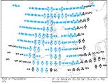
The winter weather door looks set to be opened wide on Friday. Cold, northerly winds will be sweeping through all parts of the country, bringing a risk of snow and sleet for almost all areas.
The cold weather is likely to start arriving through Thursday as low pressure moves into the North Sea. A front will be passing through Scotland and Ireland, with rain and sleet turning increasingly to snow over the hills. There is a risk of blizzards over the Highland.
Winds will be increasing through Thursday as well, with severe gales possible over western Scotland and Ireland.
Overnight into Friday morning, the band of rain and sleet is expected to pass through England and Wales. With the colder air piling into the rear of the front there is an increasing risk of the rain turning to sleet at lower levels, with snow over higher ground. Thunderstorms are likely.
By Friday all places will be bitterly cold and windy. There will be showers again, a few of them heavy.
Our latest thoughts for the weekend are that a shallow area of low pressure may move south through western parts of the country, bringing a cloudy and wet day for these areas with sleet and snow on the hills.
As always, Weatheronline will keep you up-to-date throughout.
Whatever the weather keep the sun shining!
Simon