Storms, gales and snow.
That’s April for you!
Visit www.weatheronline.co.uk - the UK's most comprehensive internet weather - talk live to our forecasters for the latest forecast and weather news. Call 09061 991 189 (Ł1.50p/min)
Issued: 0815hrs Wednesday 6th April 2005
Duty forecaster: Simon Keeling
 Cold and windy, sleet and snow
I’ve been warning for several days about the risk of a return to wintry conditions at the end of this week, and the latest forecast confirms my thoughts.
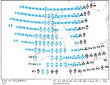
Low pressure will be moving into the northern North Sea during Thursday, with a strong north to northwest flow affecting all parts of the British Isles and Ireland. A cold front associated with the low will be from northern England to southern Ireland at midday on Thursday, this clearing southeast England overnight into Friday. It’s behind the cold front that the bitter weather is hiding.
By Thursday afternoon we can expect heavy, wintry showers for much of Scotland and Ireland, with thunderstorms thrown in for good measure. The winds will be to severe gale force, so batten down the hatches.
This sets the scene for a stormy night into Friday. Heavy showers in many places, and again these will be wintry and thundery in many areas. Coasts (apart from the south coast) will be most at risk from these showers.
If you are keen on walking, be aware that the mountains of Scotland, northern England, Wales and Ireland will have blizzard like conditions through Thursday, and then again through Friday.
As is often the way at this time of year, the cold weather won’t be lasting long, and should be much improved on Saturday, as the winds ease.
As always, Weatheronline will keep you up-to-date throughout the coming hours.
Whatever the weather keep the sun shining!
Simon