Fog & Rain
A Double Warning
Visit www.weatheronline.co.uk - the UK's most comprehensive internet weather - to get the latest weather news or talk to our forecast telephone service (09061 991 189 �1.50p/min)
Issued: 1000 GMT Monday 7th February 2005
Duty Forecaster: Simon Keeling
The weather is in a changeable mood this week, as the quiet, settled conditions of the past few days make way for more disturbed conditions to race in from the Atlantic. Each weather regime brings it's own hazards.
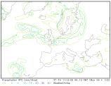 This morning saw thick fog affecting much of the country, and this is a process likely to be repeated tonight. With the ground still damp and some clearer intervals expected, fog patches could be forming fairly rapidly by late evening.
The most favoured areas for the fog tonight are the Midlands, East Anglia, southern England, eastern Wales, and at first, the Vale of York. Visibility could get to below 100 metres in places so you are advised to take care. Although not widespread, there is a chance of some icy roads to with temperatures falling close to freezing.
The fog patches should slowly clear through Tuesday morning.
That brings us onto the next concern, and that is an early warning of potentially heavy rainfall through Thursday and Friday. Timings of this event are uncertain at the moment, as is the exact location of the heavy rain.
Just now, the Weatheronline Weaher centre favours Ireland, western Wales, southwest and southern England, and the Midlands
However, this area could move north or south by several miles during the forecast s we issue over the coming days. It may be that with several hours of steady rain, there will be increasing problems on the roads due to flooding.
However, we will be keeping you informed as to developments over the coming days.
For now, keep the sun shining.
Simon