Heavy rain in coming days
Flooding in places
Visit www.weatheronline.co.uk - the UK's most comprehensive internet weather - talk live to our forecasters for the latest forecast and weather news. Call 090 666 444 80 (�1.50p/min)
Issued: 0730 Monday 10th October 2005
Duty forecaster: Simon Keeling
 Wales & Scotland Most at Risk
The unusual sight of a weak hurricane off Madeira is having an effect on the weather of the British Isles and Ireland during the coming days. The reason for this is that the low pressure (hurricane) will be drifting north, bringing it's moisture and mild air and blending this with colder air from the north.
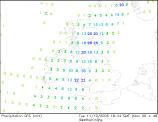
As the low moves northwards through the British Isles it will bringing heavy rain. This rain will probably be heaviest through Wales, southwest England and parts of eastern Scotland through Tuesday. There is a risk of flooding with some places seeing more than an inch of rain.
On Wednesday the heavy rain moves northwards through the Irish Sea and so we may well see between one and two inches of rain (that's up to 50mm) through parts of western England, Wales, northern England and Scotland.
If you are out and about in these regions during the next few days do take care as there will be a lot of surface water on roads and pavements.
Whatever the weather, keep the sun shining!
Simon