Severe Weather Warning
Major Storm Set to Batter Britain
Issued: 0830 Tuesday 11th January 2005
Duty forecaster: Simon Keeling
 Exceptionally strong winds to affect Great Britain and Ireland during the next 48 hours, bringing a risk of winds up to, and possibly in excess of 100mph.
The worst affected areas will be western and Northern Ireland, together with western and northern Scotland. However, gales will also affect Wales, western, northern and central England.
Winds will be increasing during this morning and afternoon, bringing severe gales to western and Northern Ireland. Through this evening and tonight the most severe winds transfer to the northwest of Scotland, and it is here that gusts may well exceed 100mph.
These winds speeds are strong enough to cause damage to power and telephone cables, as well as structural damage to some buildings and trees. If you are in these areas you should be prepared for power cuts and have supplies of food and water available.
During tonight winds in excess of gale force area expected to affect all areas north of a line from Anglesey to Derby.
A rapidly deepening area of low pressure will be responsible for the severe weather. At midday on Tuesday the low will be to the northwest of Ireland moving quickly northeast.
Here at Weatheronline we will be monitoring the situation throughout the storm and will provide a full, post storm summary. Should you need further information, or for an update on the situation you can talk to our forecasters on 09061 991 189 (calls cost Ł1.50 p/minute).
To monitor the storm from home use the following Weatheronline pages:
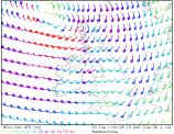
Highestwind speeds so far
Currentwind speeds
Modelforecast and data