Winter Spell Ahead?
Forecast Discussion
Issued: 1300 GMT Friday 14th November 2005
Duty forecaster: Simon Keeling
For the past few days Weatheronline forecasters have been closely watching the long range forecasts charts for the end of next week, taking us through the weekend of 22nd/23rd January.
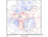
Interestingly, the GFS model (produced by the American national weather service) has been hinting at a colder snap of weather moving southwards across the UK and Ireland during this time. Now, we wouldn't normally start to alert viewers at this stage, but for several days now the model has been hinting at something colder. So what's going on?
 Well, at on Saturday we are under the influence of high pressure. This is slipping away into Europe with the milder, moister air from the Atlantic pushing through Ireland and the west of the UK. By Sunday the westerly winds will be breaking through again, bringing showers onto western coasts and a risk of gales for Scotland.
By the time we get to Tuesday the models are hinting at a very strong jet stream, almost 200mph, blowing through the north of the UK and Ireland. This is important as Atlantic weather systems get hooked up to it and then blow eastwards, making for a very unsettled spell of weather. We may see winds to 80mph once again in Scotland and Northern Ireland on Tuesday.
By Friday low pressure has passed into Scandinavia and the model wants to make this a large feature. As cold air moves into the back of it, over the British isles, a shallow low may track southeastwards through the UK. There is a risk of this bringing much colder air behind it and possibly introducing a risk of snow.
 By Sunday forecast charts are hinting at a strong north to northwesterly winds over Ireland and the UK, with high pressure to the west. This may prevent weather syetsm moving in from the Atlantic and could act as a "block", even if only for a few days.
So for the time being, Weatheronline visitors are advised to monitor the situation carefully. There is a risk of snow, especially for Scotland and eastern parts of England at the end of next week with the weather turning much colder for all of us.