Heavy bursts of rain
Very unsettled on Thursday
Visit www.weatheronline.co.uk - the UK's most comprehensive internet weather - talk live to our forecasters for the latest forecast and weather news. Call 09061 991 189 (Ł1.50p/min)
Issued: 0730hrs Monday 25th April 2005
Duty forecaster: Simon Keeling
 Rain for all, heavy at times
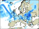
As we enter the new week, the weather is set to turn unsettled for a time. Low pressure is going to become firmly ensconced to the west of Ireland, throwing bands of rain eastwards over the coming days.
He first batch of wet weather has bee affecting southern England overnight and this morning, with 7mm of rain at Benson in Oxfordshire, 5mm at Farnborough and 3mm at Plymouth. IN fact, it’s been a wet 24hrs in parts of the southwest with 17mm recorded at Newquay to 7am this morning. You can see the latest rainfall totals yourself by clicking here.
This rain will be affecting southern Wales and the Midlands south of Birmingham this afternoon, although southern coastal counties should become drier.
However, it’s tomorrow that the first permanent band of rain sweeps northeastwards through the British Isles. This probably bringing the heaviest rain over southern coasts of England, the Welsh mountains and southern parts of the Pennines. As the rain passes northwards during the night it will be the northern Pennines and southern Uplands that see most of it, perhaps 10 to 15mm.
All eyes then turn to Thursday. It’s then that an areas of heavier rain will be moving eastwards through the country, with the winds increasing. Many parts of southwest England, Ireland, Wales, northwest England and western Scotland could see around 10 to 20mm of rain. The Midlands and eastern England will have 5 to 10mm. These aren’t huge amounts, but are certainly enough to be described as “wetö.
We’ll be monitoring things here at the Weatheronline Weather Centre and will keep you up-to-date with the latest information as we get it.
Whatever the weather keep the sun shining!
Simon