Thundery rain on the way
The devil is in the detail
Visit www.weatheronline.co.uk - the UK's most comprehensive internet weather - talk live to our forecasters for the latest forecast and weather news. Call 090 666 444 80 (Ł1.50p/min)
Issued: 0830hrs Monday 27th June 2005
Duty forecaster: Simon Keeling
 A thundery breakdown but questions remain
It's an awkward forecasting situation for the next few days. I'm happy that we are going to see some thundery rain edging northwards, but the difficulty is in deciding when and where the heaviest of any rain will be.
As of this morning I think that we should escape storms of a similar vein to those we saw last week, but nonetheless a few bursts of heavy rain are likely. Indeed, parts of Cornwall are already experiencing thundery showers this morning, although these should fade for a time through today, before returning northwards overnight.
My thoughts are that there will be a slow breakdown in the weather as we go through Tuesday, with many southern coastal counties of England, and the whole of the southwest experiencing the showers. These will be edging slowly northwards through the course of the day, although during the night the showers "jump" north, into Wales, the Midlands and East Anglia.
I then think that the rain will be moving into northern England on Wednesday, with thundery showers to the south.
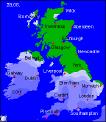
Throughout all of this, Scotland should be much brighter and drier, although there could be some drizzle in the far north.
We better then get ready for a more unsettled weekend. Low pressure in control, with stronger winds, rain and showers. Feeling much cooler too, with the most unsettled conditions to the west and north.
Whatever the weather, keep the sun shining!
Simon