Low pressure returns
Becoming chillier
Visit www.weatheronline.co.uk - the UK's most comprehensive internet weather - talk live to our forecasters for the latest forecast and weather news. Call 09061 991 189 (�1.50p/min)
Issued: 0830hrs Wednesday 30th March 2005
Duty forecaster: Simon Keeling
 Unsettled and breezy, colder
I hope that you had a good Easter Break. It seems that the weather played �ballö for a change, and most of the British Isles enjoyed some sunshine during the weekend. However, what about the weather over the coming days?
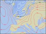
Well, it seems that a battle royal will be taking place between high pressure to the east, and low pressure to the west.
During the rest of this week a ridge of high pressure extends from the east, although weak fronts will be bringing cloud and outbreaks of rain, mainly to more northern areas.
Sunday is expected to see the main change in conditions. A cold front moves east, bringing outbreaks of rain. This eventually clears eastwards by Monday, with brighter weather and heavy showers following.
Together with brighter and showery conditions it will be turning much colder, with those showers becoming wintry over the mountains of Wales, northern England, Northern Ireland and Scotland.
Indications are then that the low pressure area stays to the north of Scotland. This will maintain the unsettled weather. Further showers are likely, and again these could be wintry at times. Most of the rainfall always in the north, with southern areas drier.
Of course, Weatheronline will be keeping you up-to-date, but whatever the weather keep the sun shining!
Simon