Sun for some, showers for others
Better early on, then rain
Visit www.weatheronline.co.uk - the UK's most comprehensive internet weather - talk live to our forecasters for the latest forecast and weather news. Call 090 666 444 80 (Ł1.50p/min)
Issued: 0930 Sunday 31st July 2005
Duty forecaster: Simon Keeling
 Enjoy the early sunshine
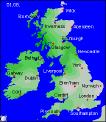
High pressure will be making a much welcomed, albeit brief, return to the British Isles and Ireland during the course of Monday and Tuesday. This should settle the weather down for most of us for a short time, before more rain returns later in the week.
Having said that, showers are likely to break out over southern and southeastern parts of England and Wales on Monday, but elsewhere it should be dry with some good spells of sunshine. It will be feeling warmer everywhere too.
Most of England and Wales should stay fine for Tuesday as well, although by then showery rain and cooler conditions will be moving through Ireland and Scotland, reaching western Wales on Tuesday afternoon.
We then have to look to the northwest of Scotland where a deep area of low pressure will be forcing strong winds, showers, or longer spells of rain through Scotland and Northern Ireland. It will also make other parts of the UK and Ireland more unsettled in sunshine and showers.
By the end of the week things look cooler. The winds may go into the northwest, bringing sunshine and more showers, mostly to northern and western areas. Of course, that is still a long way off and anything can happen in the 24 hour world of weather!
I'll have more for you in the morning.
Simon