The Summer Heat Is On!
Summary Of Daily Temperatures & Forecast
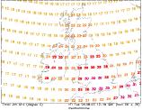
 The Heatwave So Far...
With the weekend now over, our forecast heat-wave is well underway. During Saturday (02/08/03) a weakening band of rain cleared from south-eastern parts, and by the end of the day sunshine lifted temperatures to a maximum of 27°C in London. A clear evening for many resulted in a sunny start to Sunday (02/08/03), with temperatures soon rising. Indeed, Sunday's highs far exceeded the forecast figures, with London once more recording the UK max, 30°C. Overnight temperatures began to rise with the building of humidity, and although the Channel Isles fell now lower than 16°C, many parts of England and Wales can expect warmer nights to come this week.
 This Week : Becoming Hotter!
There is much cautious excitement amongst the meteorological sector this week, with the current synoptic setup hinting at possible record breaking heat. There are complications earlier in the week however, more especially from Monday to Wednesday. The following forecast from WeatherOnline is based on the current synoptic setup, and interpretations of numerous model outputs:
Monday : High pressure migrating into the North Sea, allowing fronts to affect the extreme west. Mostly sunny across England and Wales, with max temperatures inland reaching 33°C, 26°C on the coast. Cloudier skies for Ireland,Scotland and south-west England, with the risk of isolated showers and highs here of 22-26°C.
Tuesday : Weak low slides across central parts with associated trough feature. Higher humidity across England and Wales today, with bright spells but large amounts of cloud. Risk of showers/thunderstorms, max temperature 35°C. Brigther for Ireland and Scotland, long sunny spells and highs of 27°C.
Wednesday : Pressure still low, but building from south-west once more. Trough feature clearing. Still the risk of isolated thundery showers in the east and north, but becoming mostly sunny with temperatures reaching 36°C in the south, and 28°C in the north and west.
Thursday : Azores High strengthening ridge from south-west with thermal low advecting east. A return to mostly sunny conditions for all parts, with only patchy afternoon cloud developing. Slightly cooler, with highs of 32°C in the south, 24°C in the north. Slightly less humid.
Friday : High pressure centre over the UK, frontal activity to west blocked over Atlantic. All parts once again seeing long sunny spells, with temperatures comparible to Thursday.
Outlook : The weekend will remain fine and dry for most, although the shifting position of the high pressure will mean slightly lower temperatures than mid-week. Southern parts are likely to see highs in the late twenties Celsius, low to mid twenties for Ireland and Scotland. The settled weather looks set to stay early next week, with the hint of more humid, thundery weather midweek.
To see the general weekly forecast, you can view the weekly forecast page. The following links provide forecast charts for the coming week:
Next Week's Weather : UK, Ireland
Predicted Temperatures : 2m Max, z T850hPa
NH Pressure Charts: NHSLP
Chance Of Rain? : Precip (mm), CAPE
Expert Weather Maps : here
Model Runs : here