The Heat Goes On!
Summary Of Daily Temperatures & Forecast
The Heatwave So Far...
As expected, after a very warm weekend, the week has continued to see temperatures rise further. The fantastic sight of seeing 30°C temperatures for the UK is now becoming a common one, with most parts across England and Wales exceeding this. Coasts have remained cooler throughout, with afternoon sea-breezes pegging back temperatures to a refreshing 25°C. During Tuesday, records were broken across the country due to the extreme heat. Jersey reported a temperatures of almost 35°C, the hottest August 5th since 1897. With 33°C reached, Valley on Anglesey recorded its highest ever temperature! Conditions have been very humid and oppressive, particularly at night where central London temperatures didn't fall below 22°C during the early hours of Tuesday. It wasn't so settled everywhere however, with much of Ireland, Northern Ireland and later Scotland seeing violent thunderstorms. Some parts of Northern Ireland suffered power outages as damaging lightning pounded the region yesterday afternoon. With south-westerly winds increasing, sea fog and mist became a problem around south-western coasts also. The question is, will the highest ever UK temperature of 37.1°C in Cheltenham in 1990 by broken this week?
 This Week : Heat Continuing
Conditions will remain settled and very warm until the end of the week. There is some uncertainty currently however into the weekend and beyond. Atlantic weather fronts are expected to attempt to move eastwards, but their progress will be eratic and they may not reach central parts at all. Despite the complex situation for next week, our current heatwave forecast for the next 7 days is as follows:
Wednesday : High pressure recovering as weak low fills and trough exits to north-east. Weak SW flow in southern parts. Gloomy, misty start around SW coasts, with showers clearing far north-east. Thereafter mostly sunny, with max temps reaching 35°C in the south (so no records broken), 26°C in the north. Cooler coasts.
Thursday : High pressure centred over UK with weak easterly in southern parts. Sunshine more prominent today with less mistiness in the south. Feeling slightly fresher, but top temperatures still reaching 32°C in southern parts, 25°C in the north.
Friday : Anticyclonic centre drifting north-east, allowing southerly flow to strengthen in the west. Potential thermal low over France affecting the south coast. Mostly sunny once more, and hot again with highs of 33°C. Breezier in the west so cooler here, as well as on coasts. Risk of isolated thundery shower in south later.
Saturday: Pressure gradient increasing in west as Atlantic low builds against high pressure over North Sea. Trailing front moving in from west. England, Wales and Scotland hot and sunny, highs of 35°C in south, 27°C in north. Cloudier across Ireland, risk of showers, but remaining warm with highs of 27°C.
Sunday: Fronts becoming blocked by anticyclone and weakening along with southerly flow. Remaining hot and sunny in the east, up to 35°C in long sunny spells. Cloudier in the west with scattered showers/thunderstorms, but this fragmenting with sunny spells later. Highs here of 23-27°C.
Outlook : Next week will see a slow degradation of high pressure from both the east and the west. It is expected to remain very warm until mid-week with sunny spells and highs of 32°C in the south. Beyond Wednesday, we are currently expecting the increased risk of thundery activity as fronts move in slowly off the Atlantic.
To see the general weekly forecast, you can view the weekly forecast page. The following links provide forecast charts for the coming week:
Next Week's Weather : UK, Ireland
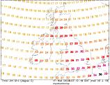
Predicted Temperatures : 2m Max, z T850hPa
NH Pressure Charts: NHSLP
Chance Of Rain? : Precip (mm), CAPE
Expert Weather Maps : here
Model Runs : here