Slightly Fresher, But The Heatwave Goes On!
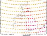
Summary Of Daily Temperatures & Forecast
The Heatwave So Far...
Well, the official record was not broken, but only just! Other records have been tumbling however over the past week, including the warmest ever August 5th temperature in Cambridge, London's highest temperature (35.7°C) and Valley's highest ever temperature (33°C on Anglesey). Wednesday saw the hottest temperature of the year, in Gravesend (Kent) at 36.4°C, this just 0.7°C short of the UK record of 37.1°C in Cheltenham, 3rd August 1990. Sunshine has been in plentiful supply throughout the week for most parts, as has high humidity and oppressiveness. Overnight, some parts of southern England haven't dropped below 22°C, making sleeping a real chore! During Wednesday and more especially Thursday, lighter winds allowed problems with coastal fog and low cloud. Places worst affected were the south-west, north-west and north-east of England, where many parts remaining cloudy for much of the day. Top temperatures during Thursday were slightly down on mid-week values, with a slight northerly drift allowing for a slightly fresher feel.
 This Week : Temporarily Cooler in N&W
A cold front is expected to bring a welcome change in temperatures for many parts over the weekend, with slightly cooler conditions spreading from the north-west. This will not affect the south-east however, which will remain hot throughout. The heat-wave is expected to build once more next week.
Friday : High pressure dominating for most, very weak flows. A dull start, mostly around coasts where fog may persist for much of the day. Becoming sunny elsewhere, and hot once more, with highs in the south of 33°C, ranging from 25°C-28°C in the north. Expect only 20-22°C where cloud remains.
Saturday : High pressure remains, cold front edging across Ireland later. Gloomy skies again for many to start, once more persisting in the east with highs of only 20°C. Sunny and hot elsewhere, 32°C in the south, 28°C in the north. Cloudier across Ireland, possible showers. Highs here of 19°C-24°C.
Sunday : Pressure remaining generally high, cold front edges further east reaching mainland UK. Cloudy skies for Scotland, N England and western mainland coasts. Odd shower in north. For Ireland, bright/sunny and fresher, 20-22°C. For C&S England & Wales, sunny and hot, 28°C-32°C, fog on east coast in places.
Monday : Cold front stationary through SW England, Wales, N England & E Scotland, pressure still high. Hot and sunny in the south-east, highs of 33°C. Cooler and fresher in west and north, 20-24°C but still sunny. Cloudy along cold front, cloud mostly breaking but odd shower in heat of day across high ground.
Tuesday: Front weakening, new ridge building from SW to merge with high. Hot in the south-east with sunny spells, 31°C the max. Some cloud in central parts, but still warm here. Elsewhere, sunny spells with temperatures increasing, 22°C-25°C, but some coastal mist persisting.
Outlook : We are expecting high pressure to dominate the rest of the week, but with light winds coastal mist and fog may continue to be a problem. Temperatures rising through the week, with highs of 25°C in the north, 29°C in the south, so not as hot or oppressive as lately.
To see the general weekly forecast, you can view the weekly forecast page. The following links provide forecast charts for the coming week:
Next Week's Weather : UK, Ireland
Predicted Temperatures : 2m Max, z T850hPa
NH Pressure Charts: NHSLP
Chance Of Rain? : Precip (mm), CAPE
Expert Weather Maps : here
Model Runs : here