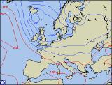
Long-range Outlook: 05/04/04 - 11/04/04
Staying unsettled with showers or longer spells of rain.
Please click here for details of the weather over the next few days.
Monday 05/04/04 to Tuesday 06/04/04
After the mild spell of weather, much of the UK will see temperatures back to normal on Monday. It will remain unsettled however, with a fresh west to north-westerly wind. Outbreaks of rain will affect eastern Scotland at first, but these should clear by midday. All parts will then have a mixture of sunny spells and showers, the showers heaviest and more frequent across Northern Ireland, western Scotland and western parts of England and Wales. Some southern and eastern parts will stay mostly dry. There will be little change on Tuesday, with further heavy showers piling into northern and western parts, some with hail and the risk of thunder. Although eastern and southern parts will have the best of the sunny spells, showers will become more organised at times, and spread across the whole country in coherent bands. Feeling rather chilly with the north-westerly wind, despite near-average temperatures.
 Wednesday 07/04/04 to Thursday 08/04/04
Conditions are set to turn colder still on Wednesday, as the winds turn more northerly for a time. This will mean a re-distribution of any showers which develop, such that the majority will affect northern and eastern parts of Scotland, together with eastern coasts of England. Some of the showers will be heavy, and may turn wintry over the highest ground in Scotland. For the rest of the UK and Ireland, it will become mostly dry with some sunny spells, and only isolated coastal showers in north and west Wales. The northerly breeze will ease on Thursday, so it won't feel quite as cold. However, a band of cloud will work its way south-eastwards, giving outbreaks of showery rain, some heavy. Western and southern parts may well stay mostly dry with some brightness, with the heaviest of the rain always in the north and the east.
 Friday 09/04/04 to Saturday 10/04/04
The northerly winds look set to return on Friday, bringing further heavy showers across many parts. Once again, the heaviest showers will be across Northern Ireland, northern and eastern Scotland, eastern parts of England and Irish sea coasts of Wales. It may well be cold enough for snow over the Scottish mountains. Southern parts of England should stay mostly dry, but even here scattered afternoon showers are possible. The winds will ease on Saturday, but are expected to become more north-easterly, so it will still feel rather cold compared to of late. Showers will be less numerous, and will become restricted to eastern parts of England and eastern Scotland. For remaining parts of Ireland, England and Wales, it will be mostly dry with some sunny spells. Later in the afternoon thicker cloud will nudge up into south-western parts of Ireland, heralding rain later.