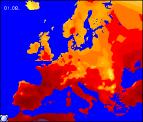
Long-range Outlook: 04/08/04 - 09/08/04
Hot and thundery at first. Becoming cooler and very unsettled later.
Click here for details of the weather over the next few days.
Please note that forecasting beyond five days is notoriously difficult, and small errors at short-range can lead to large deviations further in time. Our longer-range forecasts are based on the most accurate weather data available at the time, but alterations may be required as the period progresses. Please check back regularly for the most up-to-date forecast run.
Wednesday 04/08/04 to Thursday 05/08/04
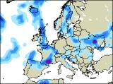
On Wednesday morning, any thundery showers will become confined to eastern parts of England and eastern Scotland, and it will stay rather muggy here. Everywhere else, it will feel somewhat fresher although still rather warm. Central and western parts of England will have some sunshine, as will Wales initially. During the afternoon, more showery bursts of rain will spread in from the south-west however, affecting much of Ireland, Northern Ireland and western Scotland, moving into Wales and south-west England by evening. With low pressure close-by on Thursday, the brief settled spell will seem like a distant memory! Outbreaks of heavy rain will affect many parts, as overcast skies slowly move north-eastwards. The heaviest rain, perhaps with thunder, will be across Scotland, northern and eastern parts of England, and Northern Ireland. Remaining parts may see some sunny spells in the afternoon, but also the risk of heavy showers. At least it will still be fairly warm across the UK and Ireland.
 Friday 06/08/04 Saturday 07/08/04
Friday should be a somewhat better day, with less cloud around and more in the way of sunny spells. The best of the sunshine will be across England and Wales, as a ridge of high pressure moves across northern France. However, low pressure will be winding up in the Atlantic, approaching Northern Ireland and Scotland during the day. This will spread thicker cloud in from the west across these parts, together with freshening south-westerly winds and outbreaks of showery rain, heavy later. On Saturday, this fairly deep area of low pressure will affect much of the UK, with a band of heavy rain sweeping north-eastwards. Ahead of this across eastern England, it may be a warm and humid start. However, the rain will soon arrive here, and at the same time will clear to blustery showers across Ireland. Feeling fresher everywhere, especially in the brisk westerly winds.
 Sunday 08/08/04 Monday 09/08/04
The area of low pressure is expected to be firmly in charge on Sunday, lying right across the UK. This will give some extremely unsettled weather, with outbreaks of heavy rain interspersed with heavy showers. Some of the showers will be heavy enough to produce local flooding, hail, and thunder. There will be a few warm sunny spells around, although these will be the exception. The good news at present, is that the low pressure centre will move away north-eastwards on Monday, allowing high pressure to ridge in from the south-west. This means that much of Ireland, Wales and England should become more settled with sunny spells. However, Scotland and Northern Ireland will still be rather windy with rain at times. Please check back for further forecast updates on next week's weather.