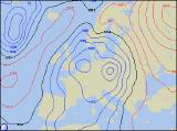
Long-range Outlook: 05/12/05 - 10/12/05
Unsettled with showers.
Click here for details of the weather over the next few days.
Please note that forecasting beyond five days is notoriously difficult, and small errors at short-range can lead to large deviations further in time. Our longer-range forecasts are based on the most accurate weather data available at the time, but alterations may be required as the period progresses. Please check back regularly for the most up-to-date forecast run.
Monday 05/12/05 to Tuesday 06/12/05
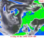
Low pressure will be the dominating weather feature across the UK and Ireland during Monday, becoming almost stationary in the North Sea. Despite drawing in a brisk north-easterly wind, it won't be a particularly cold wind this time around. However, the East Coast of England and Scotland will still pick up plenty of showers, some heavy, and they will be sleety over the hills and mountains. A northerly wind across the western side of the UK and across Ireland will blow showers across Irish Sea coasts, although away from these coasts, it will be dry with some sunshine. The north to north-easterly wind will continue through Tuesday, blowing in showers to the usual prone areas. These will be across Northern Ireland, squeezing down the western side of Scotland, into the Irish Sea and thus affecting the western side of Wales and south-west England, and also down North Sea coasts of England and Scotland. The showers will sometimes be of hail and sleet, with a risk of thunder through the Irish Sea. Away from these areas, it will remain mostly dry with some sunny spells.
 Wednesday 07/12/05 to Thursday 08/12/05
Wednesday will be a very similar day to Thursday, with sunshine in places, and showers in others. However, as the wind becomes more east to north-easterly, the distribution of showers will alter. Any morning showers affecting west Wales, south-west England and western Scotland will move out further into the Irish Sea, lapping onto the coast of eastern Ireland. The rest of Ireland will be dry with some sunshine. North Sea showers will keep going along the east coast of England and Scotland, some wintry, but inland it will continue mainly dry, if rather cloudy. Model variations are resulting in lower confidence in the forecast from Thursday onwards, although indications are all pointing to a change for the second half of next week. As low pressure slowly pulls away, England, Wales and most of Ireland will have a much cloudier day, with showery bursts of rain spreading southwards. Scotland and the far north of England is likely to have a chilly and locally frosty start, but this will lead into a mainly dry day with some sunny spells.
 Friday 09/12/05 to Saturday 10/12/05
High pressure is expected to build across the north of the UK during Friday, resulting in a fine day across Northern Ireland and Scotland, with sunny spells after a frosty start. Most of northern England and the Irish Republic can also expect a mainly dry day with some brightness. For the rest of England and Wales, it will still be rather cloudy. A few showers will affect North Sea coasts, from East Anglia southwards. At the same time, showers are expected to linger through the Channel, moving inland from time to time. On Saturday, the northern half of the UK will continue to be influenced by high pressure, and will remain mostly dry with some sunny spells. Low pressure over France will start up a strong easterly wind across the southern half of the UK and across Ireland, making it feel cold. There'll be a lot of cloud acorss these areas, with outbreaks of rain. Most of the rain will be across southern England and south Wales, where some will be heavy. For more details on the end of next week, please check back for further forecast updates.