Long-range Outlook: 05/01/05 - 10/01/05
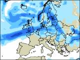
Often very windy with rain for all.
Click here for details of the weather over the next few days.
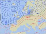
Please note that forecasting beyond five days is notoriously difficult, and small errors at short-range can lead to large deviations further in time. Our longer-range forecasts are based on the most accurate weather data available at the time, but alterations may be required as the period progresses. Please check back regularly for the most up-to-date forecast run.
Thursday 06/01/05 to Friday 07/01/05
On Thursday, a brief ridge of high pressure will give much of England and Wales a dry day with some sunny spells. However, freshening south-westerly winds across Ireland, Northern Ireland and western Scotland will already be bringing outbreaks of rain from the west, and this will spread to western parts of Wales and northern England later. Becoming mild once again, although still fairly chilly in the east. Friday will remain very unsettled, as low pressure dominates the North Atlantic. Westerly winds will reach gale, possibly severe gale force around western coasts of Scotland and Northern Ireland, especially later in the day. Outbreaks of rain will affect most of Ireland, England and Wales for much of the afternoon, although south-east England could just remain dry. Rain will tend to be more showery across Scotland for a time, but will become persistent later.
 Saturday 08/01/05 to Sunday 09/01/05
Southern parts of the UK are looking particularly wet on Saturday, as a developing depression runs through the English Channel. Outbreaks of heavy rain and gusty winds will sweep across most of south Wales, central and southern England and East Anglia through the day. Elsewhere, across the rest of England and Wales, together with all of Ireland and Scotland, there will be some brighter spells, but also scattered showers. These will be wintry over the Scottish mountains. On Sunday, central and eastern parts of England and Scotland will have a respite from the unsettled weather, with bright or sunny spells after a chilly start. It will also be bright elsewhere for a time, but another low pressure area will sweep wind and rain across Ireland, Northern Ireland and western Scotland by midday, reaching Wales and western England through the afternoon.
 Monday 10/01/05 to Tuesday 11/01/05
On Monday, a vigorous low pressure is expected to sweep across Scotland. Weather fronts will spread rain across most of the UK, with some heavy downpours and squally winds likely. The rain will become confined to eastern England and Scotland through the afternoon, although it may return to western Scotland later. Elsewhere, heavy and thundery showers will follow the rain, with sunny spells in between. Gales are likely through the English Channel for a time. It’s expected to turn colder on Tuesday, as winds swing around to the north-west. Showers will turn increasingly to sleet and snow across Scotland and northern England. Elsewhere it will become mostly dry with some sunny spells, although as high pressure builds it’s expected to turn frosty in many places overnight. Please check back for further forecast updates.