Long-range Outlook: 07/02/05 - 12/02/05
Cold at first. Briefly milder, then colder again.
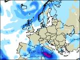
Click here for details of the weather over the next few days.
Please note that forecasting beyond five days is notoriously difficult, and small errors at short-range can lead to large deviations further in time. Our longer-range forecasts are based on the most accurate weather data available at the time, but alterations may be required as the period progresses. Please check back regularly for the most up-to-date forecast run.
Monday 07/02/05 to Tuesday 08/02/05
Our previous update was hinting at some very cold weather across the UK and Ireland on Monday, and to some degree this will still be the case. However, there will be a weather battle ground, as mild south-westerly winds to the west of Ireland, push up against colder air elsewhere. Showery rain will turn to snow over the the hills of Ireland and Northern Ireland, with a few spots of sleaty rain across south-west England at first. Elsewhere, after a widespread and hard frost, it will be a dry day with sunny spells, although isolated snow flurries cannot be ruled out in the east. On Tuesday, winds will turn south-easterly across England and Wales, but whilst this won't be particularly cold air, it will prevent weather fronts further west from spreading eastwards. These fronts will give prolonged and sometimes heavy rain to most of Ireland and western Scotland, turning to snow over the hills of Scotland. England and Wales will remain dry with sunshine after a frosty start.
 Wednedsay 09/02/05 to Thursday 10/02/05
South-easterly winds will continue to give mostly settled weather across England and Wales on Wednesday, with bright or sunny spells after a chilly and frosty morning. Across Ireland, Northern Ireland and Scotland, it will be mostly cloudy with spells of showery rain. Much milder in the north, with fresh to strong westerly winds continuing, although it could be chilly in eastern Scotland to begin with. On Thursday, the milder air will sweep eastwards across all areas, as a band of rain or sleet crosses England and Wales during the morning. This rain could take some time to clear from south-east England, and at the same time another spell of wet weather will return to Scotland. With westerly winds elsewhere, there will be a mixture of brighter spells and showers, some heavy. Towards evening, colder air will begin to return to western Scotland as winds turn north-westerly.
 Friday 11/02/05 to Saturday 12/02/05
The weather on Friday is looking potentially stormy, as a deep area of low pressure crosses Scotland. Confidence on this scenario is low at present, but this would bring plenty of heavy rain and strong winds to most places. Through the weekend, current indications are for another cold blast, as winds turn northerly. Typically, this would give much of the country some crisp winter sunshine, but prone coastal areas in the north and east would be likely to see some snow showers. However, more detail will be given on next weekend in the next forecast update.