Weekly Outlook : 03/09/03-09/09/03
Mostly Settled, Warm Until Weekend. Unsettled From Weekend Onwards.
 Wednesday 03/09/03 to Thursday 04/09/03
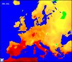
Wednesday morning will see high pressure dominating the weather across the UK. Many parts will therefore have a bright morning, although long sunny spells will be spoilt by large areas of cloud floating around. Into the afternoon, little change although the sun should make more of an appearance across central and southern parts. Feeling warm here, with highs in the low twenties Celsius. Overnight it will become clear and chilly across mainland UK, but across Ireland the south-west wind will increase. For most of the UK, Thursday will be another similar day, with sunny spells and calm, settled conditions. Temperatures will be a shade up also, reaching the mid twenties in central-southern England. A change across western parts of Ireland and Northern Ireland however, as south-westerly winds continue to increase and skies cloud over. Towards evening rain will arrive, some of it heavy but remaining dry and fairly clear during the evening and night elsewhere.
 Friday 05/09/03 to Saturday 06/09/03
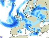
Unsettled conditions beginning to take hold across much of Ireland and Northern Ireland on Friday, with spells of rain and cloudy skies. After a bright start this will spread eastwards into western parts of Scotland as well. For northern England, much of Wales and the north Midlands, another mostly bright, dry day with spells of sunshine. Southern England will be at risk from some scattered heavy showers as a weak low pressure area crosses the Channel. Showers should die out overnight, although the odd scattered thunderstorm cannot be ruled out. Into Saturday however, things will become increasingly unsettled for Scotland and Northern England. Cloud and rain, sometimes heavy will cross from west to east, turning brighter and drier across much of Ireland during the afternoon. Across the rest of England and Wales, a lot of cloud and the odd shower, but sunny spells from time to time. Temperatures near average for the time of year, cool in the north.
 Sunday 07/09/03 to Tuesday 09/09/03
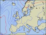
Sunday will be a largely unsettled day, with a good deal of cloud across all parts. Almost anywhere could see rain or showers, and at this time it is difficult to predict which areas will be most affected. South-western parts will stand the best chance of staying dry, although it will be rather windy here. Into Monday, low pressure looks set to deepen significantly to the south-west, with bands of heavy rain spreading across England, Wales and Ireland. Winds may touch gale force in exposed coastal regions. Rather cloudy with showery rain elsewhere during Monday, but by Tuesday all parts will see a mixtures of heavy rain followed by sunshine and showers. A point of note for later in the week; there is that chance that a deep low pressure area, the remnants of Hurricane Fabien may reach out shores, but this is just a 10% risk at present. More details in the next forecast update.