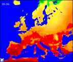
Long-range Outlook: 07/06/04 - 12/06/04
Warm & muggy with the risk of thunder. Cooler by the weekend.
Click here for details of the weather over the next few days.
Please note that forecasting beyond five days is notoriously difficult, and small errors at short-range can lead to large deviations further in time. Our longer-range forecasts are based on the most accurate weather data available at the time, but alterations may be required as the period progresses. Please check back regularly for the most up-to-date forecast run.
Monday 07/06/04 to Tuesday 08/06/04
Our previous forecast for settled conditions on Monday is holding true, with high pressure over southern parts. There will be rather more cloud around than originally forecast, however much of England and Wales will still have a bright and warm day with temperatures in the mid twenties Celsius. Northern Ireland and Scotland will also be rather cloudy at times, but any drizzle will be reserved for the Northern Isles. Winds will be light everywhere, although a southerly will freshen across Ireland later. On Tuesday, there will be more in the way of sunshine for much of the UK, and with a south-easterly breeze developing it will become very warm in the south, with maximum temperatures in the mid to high twenties Celsius. Western parts of Ireland and Northern Ireland will cloud over through the day however, with the risk of showery rain towards evening. Winds will be fresh here, becoming strong along the west coast later.
 Wednesday 09/06/04 to Thursday 10/06/04
Early on Wednesday, cloud and showery bursts of rain will spread eastwards across many parts, perhaps with a rumble or two of thunder. This rain will affect eastern parts of England and much of Scotland, but the rest of England and Wales will become brighter and fresher. Northern Ireland will probably stay rather wet for much of the afternoon as well, but sunshine and showers will follow the rain across the Republic of Ireland. On Thursday, western parts of the UK, including much of Ireland will be rather cloudy with heavy bursts of rain, some thundery. England and Wales will become rather warm once again, but during the afternoon scattered showers and thunderstorms will drift northwards. Some places will remain dry and bright, but where the showers break out they will give some lengthy downpours. The best of the drier, sunnier weather will be across Scotland, but even here it will be rather muggy.
 Friday 11/06/04 to Saturday 12/06/04
Low pressure will dominate the weather across much of the UK on Friday, although the low centre will remain to the west of the UK. This will encourage a southerly flow for all parts, thus bringing some warm, humid air. There will be some sunshine, especially across England and Wales, but showers and thunderstorms will break out once again in the afternoon. After a bright day on Thursday, Scotland will be rather overcast with outbreaks of rain on Friday, some heavy. On Saturday, cooler and fresher conditions are expected to cross many places, with a north-westerly wind developing behind the low pressure. Outbreaks of rain will cross much of Scotland and England during the morning, and thereafter much of the UK will have a mixture of sunny spells and scattered showers.