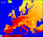
Long-range Outlook: 08/09/04 - 13/09/04
Fine and sunny until the weekend. Unsettled thereafter.
Click here for details of the weather over the next few days.
Please note that forecasting beyond five days is notoriously difficult, and small errors at short-range can lead to large deviations further in time. Our longer-range forecasts are based on the most accurate weather data available at the time, but alterations may be required as the period progresses. Please check back regularly for the most up-to-date forecast run.
Wednesday 08/09/04 to Thursday 09/09/04
High pressure will remain dominant across most of the UK and Ireland on Wednesday, resulting in fine, settled conditions. With only patchy cloud developing through the afternoon, and long spells of sunshine, it will feel pleasantly warm once again. However, the easterly breeze may give more cloud along North Sea coasts of England. It will also become quite strong through the English Channel and along southern coasts of the Irish Republic. As a result, it will feel cooler here. After a chilly night on Wednesday night, perhaps with ground frost in parts of Scotland, Thursday will be another fine day with lots more sunshine. The easterly wind will ease in the south, so it won't feel as cool as on Wednesday. However, exceptions will be southern parts of Ireland, the Isles of Scilly and the Channel Isles, where scattered thundery showers may develop by evening.
 Friday 10/09/04 Saturday 11/09/04
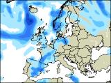
At present, a break-down in the recent settled weather looks set to begin on Friday, as weather fronts move up from the south. Ahead of this, across most of England and Wales, it will be another warm day with plenty of sunshine. The same is true of Scotland and Northern Ireland, although the sunshine will turn hazy later. Across southern England, south Wales and southern parts of Ireland, thickening cloud will threaten showery rain during the afternoon, and this may become heavy with the chance of thunder. On Saturday, this thundery rain is expected to spread slowly northwards, affecting most of England and Wales during the afternoon. Southern parts of Ireland will also have a showery spell of rain, but Northern Ireland will remain mostly dry and bright. Scotland will also escape mostly dry, although sunny spells will be fewer. Feeling a little cooler everywhere, especially in the rain.
 Sunday 12/09/04 Monday 13/09/04
Low pressure will become firmly in charge by Sunday, translating into more unsettled weather. It will always stay fairly warm though, as winds remain south or south-westerly. Northern Ireland and Scotland will also remain largely dry too, with showers always well scattered. The focus of the heavy rain will be across Ireland, Wales and central and southern England, again with the chance of thunder. However, by Monday, a total change in the weather is expected, as a deep area of low pressure moves in from the west. This will give a spell of heavy rain across all parts as cloud sweeps eastwards, and westerly winds will become strong and gusty in places. Feeling much cooler too, with any warmer weather soon exiting from the south-east. As ever, please check back for further updates on next week's weather.