Long-range Outlook: 08/11/04 - 13/11/04
Mostly fine with high pressure. Chilly winds.
Click here for details of the weather over the next few days.
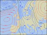
Please note that forecasting beyond five days is notoriously difficult, and small errors at short-range can lead to large deviations further in time. Our longer-range forecasts are based on the most accurate weather data available at the time, but alterations may be required as the period progresses. Please check back regularly for the most up-to-date forecast run.
Monday 08/11/04 to Tuesday 09/11/04
The start to next week is currently looking fairly settled, with high pressure dominating to the west of Ireland. However, it will be a rather "cloudy high" for most places. On Monday, much of the UK and Ireland will be cloudy, and this will be thick enough for the odd spot of drizzle across England and Wales. The best of any bright or sunny spells will be across western Scotland and Ireland, although even here it will be predominantly cloudy. On Tuesday, there will be very little change, although cloud amounts will tend to reduce and there will be more in the way of brightness. Once again, the best of any sunshine will be across Ireland, Northern Ireland and south-western parts of England and Wales. Winds will remain generally light, although they will be fresher across northern Scotland and eastern parts of England, where there is always the risk of a few patches of drizzle
 Wednesday 10/11/04 toThursday 11/11/04
Models are suggesting that the area of high pressure will drift eastwards during Wednesday, directly over parts of northern England. This means that it will be a fairly chilly start across Northern Ireland and northern England, with frost and fog patches possible. However, there will be a better chance of some sunny spells during the day, and it will feel pleasant in light winds. It should be dry across Scotland too, with variable cloud, but across Wales, the Midlands and southern England, it will stay mostly cloudy with a few spots of rain. On Thursday, the high will continue its journey slowly eastwards, allowing more of a southerly breeze to develop. Amounts of sunshine will also increase, especially across southern parts of England and Wales where it will have been rather cloudy for some time. All parts will remain dry through the day, and with clearing skies a few patches of fog and frost will form almost anywhere.
 Friday 12/11/04 to Saturday 13/11/04
High pressure is expected to hold into Friday, although it will have drifted eastwards somewhat. There will be more cloud around once again, as weak fronts try to move from the west across Ireland and Northern Ireland. The best of the sunshine will be across northern England and Scotland, although it will be a cold and frosty start here. The detail for Saturday and the weekend is currently rather uncertain, and thus confidence will be increased during later forecasts. However, there is the potential for a strong northerly flow to develop, turning the weather much colder across the entire country. Frost will become widespread overnight, especially across Scotland. Wintry showers are also likely based on current models, with snow falling to low levels across the north. However, with confidence on this being low, please check back for further forecast updates.