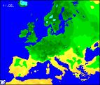
Long-range Outlook: 09/05/05 - 14/05/05
Becoming fine for many. Rain in the far south.
Click here for details of the weather over the next few days.
Please note that forecasting beyond five days is notoriously difficult, and small errors at short-range can lead to large deviations further in time. Our longer-range forecasts are based on the most accurate weather data available at the time, but alterations may be required as the period progresses. Please check back regularly for the most up-to-date forecast run.
Monday 09/05/05 to Tuesday 10/05/05
High pressure to the west of Ireland, and low pressure in the North Sea, will give a cool northerly wind everywhere on Monday. These winds will blow in plenty of showers across Scotland, some wintry over the mountains, although sheltered parts of southern Scotland could remain dry. Showers will also affect eastern and western coasts of Northern England, as well as North Wales, perhaps drifting into the Midlands later. One or two showers are likely too in Northern Ireland, although these will die out later. Ireland, together with remaining parts of England and Wales will be dry with some pleasant sunny spells. On Tuesday, the area of high pressure is expected to drift eastwards directly over the UK. After a chilly, perhaps frosty start in a few places, it will be a generally dry day with variable cloud and sunny spells. However, northerly winds will continue to blow in a few showers across Eastern Scotland and Eastern England, and it will feel cold here in the wind. Pleasant elsewhere in the sunshine, although temperatures will be around average for the time of year.
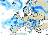
 Wednesday 11/05/05 to Thursday 12/05/05
High pressure will persist during Wednesday, with much of the UK having another dry and bright day with spells of sunshine. However, there will be a couple of exceptions. Weak weather fronts across the far north of Scotland will give rather cloudy skies, perhaps with a few spots of rain. Across southern England and southern parts of Ireland, a cool easterly wind will pick up through the day, bringing in a lot of cloud towards evening. During Wednesday night, rain will reach parts of south-west England, some heavy. There will be a north-south split in the weather on Thursday, as high pressure continues to dominate northern parts with warm sunshine, and low pressure winds up to the south-west of the UK. This area of low pressure will spread cloud and rain slowly northwards across south-west England, south Wales and southern parts of Ireland. The easterly wind will also become strong and gusty at times. Central areas of England and Wales will be mainly dry but with more in the way of cloud around.
 Friday 13/05/05 to Saturday 14/05/05
On Friday, unsettled conditions will affect the extreme north and extreme south of the UK. Across Northern Scotland, weather fronts will return to give more prolonged outbreaks of rain, although these will be restricted to areas north of the Great Glen. At the same time, cloud and showers will also affect the extreme south of England, together with gusty east winds. The rest of the UK and Ireland will stay dry with some sunny spells. Another ridge of high pressure looks set to build in from the west during Saturday, pushing away any lingering cloud and rain in southern areas. However, winds will remain from a generally north or north-westerly direction, so nowhere will be particularly warm. As ever, please check back for further forecast updates.