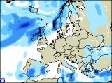
Long-range Outlook: 11/01/06 - 16/01/06
Rain for most. Generally mild.
Click here for details of the weather over the next few days.
Please note that forecasting beyond five days is notoriously difficult, and small errors at short-range can lead to large deviations further in time. Our longer-range forecasts are based on the most accurate weather data available at the time, but alterations may be required as the period progresses. Please check back regularly for the most up-to-date forecast run.
Wednesday 11/01/06 to Thursday 12/01/06
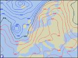
The UK and Ireland will be between weather systems on Wednesday, with one cold front slowly clearing from southeast England, whilst more fronts pile into north-west Scotland. The rain in the southeast could be heavy during the morning, but it will move away in the afternoon. Thereafter, most of England and Wales, together with the Irish Republic will be dry with sunny spells and light winds. Scotland and Northern Ireland will also start dry with a touch of frost, but thickening cloud will spread rain across all but the southeast of Scotland by evening. Becoming windy across the north. High pressure will build across eastern areas during Thursday, giving a dry day with some sunny spells across most of England, together with eastern Scotland. However, it will be chilly at first, with a frost in places. Across Wales and northwest England, it will be cloudier and breezy with coastal drizzle. Rainfall will be more active across western Scotland and much of Ireland, accompanied by strong southerly winds. There will be a risk of gales on western coasts.
 Friday 13/01/06 to Saturday 14/01/06
Friday the 13th will be unlucky for western parts of the UK and Ireland, whilst the east enjoys better fortunes. High pressure will dominate the weather across the majority of England and Wales, with sunny spells after a locally frosty start. Atlantic fronts will continue to give a lot of cloud across Ireland, Northern Ireland and Scotland, with rain at times. This will be heaviest in western areas, where southerly winds will remain strong. Later in the day, drizzly rain will reach western coasts of Wales and southwest England. The forecast models deviate further by Saturday, thus confidence is reduced for the forecast outlook. At present, it looks likely that a small area of low pressure will develop to the southwest of the UK, helping to push cloud and rain eastwards across most of the UK. One area of patchy rain will affect England during the morning, before it turns drier for a time. However, more rain across Ireland during the morning will spread to all but eastern parts of England through the day. Scotland should have the best of any sunny spells, but there will be showers too.
 Sunday 15/01/06 to Monday 16/01/06
Sunday is currently looking set to be unsettled across most of the UK and Ireland, with showers or longer spells of rain. Some of the rain will be heavy, and with very light winds it will last in some areas for much of the day. Perhaps the best of the weather will be in western parts of Ireland, where sunny spells will develop during the afternoon. Little change is expected during Monday, although as pressure starts to build across southern areas, the worst of any rain will become restricted to northern and western areas. In general, temperatures will be around average for mid-January, although slightly above in southwestern areas. As ever, please check back for further forecast updates.