Long-range Outlook: 12/02/05 - 17/02/05
Unsettled with brief cold spells.
Click here for details of the weather over the next few days.
Please note that forecasting beyond five days is notoriously difficult, and small errors at short-range can lead to large deviations further in time. Our longer-range forecasts are based on the most accurate weather data available at the time, but alterations may be required as the period progresses. Please check back regularly for the most up-to-date forecast run.
Saturday 12/02/05 to Sunday 13/02/05
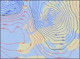
Saturday will start on an unsettled note, as a deep area of low pressure clips the north of Scotland. Heavy rain will sweep across England and Wales during the morning, but should have cleared to sunny spells and scattered blustery showers by early afternoon. However, the rain will be slower to clear across Scotland, and could persist for much of the day in the north, together with strong to gale force north-westerly winds. Ireland and Northern Ireland will have a straight forward day of sunshine and showers, heaviest and most frequent in the west. Sunday will be a shock to the system for many, as winds turn northerly introducing much colder air. Winds could touch gale force in eastern Scotland and eastern England, bringing in plenty of heavy showers. These will fall as sleet and snow across Scotland and north-east England, with hail and sleet further south. Western parts of England and Wales, along with Ireland, will be dry with sunny spells after overnight frost.
 Monday 14/02/05 to Tuesday 15/02/05
Sunday's colder weather will have been very short-lived, as winds swing back to a west or north-westerly direction by Monday. Outbreaks of heavy rain will sweep across Scotland and Northern Ireland, preceded by a dusting of snow over the Scottish hills and mountains. Northern England will also catch some of this rain after a bright start, whereas the rest of England and Wales should have a dry and bright day. The Republic of Ireland will also be dry, although will become increasingly cloudy. On Tuesday, much of the UK and Ireland will be a strong westerly airflow. Weather fronts draped across most of Ireland, northern England and north Wales will give a cloudy day with outbreaks of showery rain. To the south of this, across south Wales and southern England, it will be very mild and mostly dry, albeit rather cloudy. Further north across Scotland and the north of Northern Ireland, it will be brighter but colder with scattered wintry showers.
 Wednesday 16/02/05 to Thursday 17/02/05
We're expecting a two-way split in the weather on Wednesday, as high pressure begins to build in from the west. This will give most of Ireland, Northern Ireland, Wales and south-west England a dry day with occasional sunny spells. However, Scotland and most of eastern England will hang on to a good deal of cloud, with outbreaks of showery rain. Confidence for the end of next week is currently low, but there are indications that high pressure will take control of the UK's weather. Due to the high's suggested position, England and Wales will be sunny by day, but cold and frosty by night. Northern Ireland and Scotland will always be at risk from weather fronts brushing by to the north, so there'll be more cloud around with the risk of drizzle. As ever, please check back for further forecast updates for next week's weather.