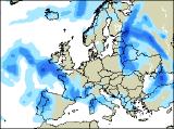
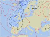
Long-range Outlook: 14/05/05 - 19/05/05
Becoming unsettled with rain for all.
Click here for details of the weather over the next few days.
Please note that forecasting beyond five days is notoriously difficult, and small errors at short-range can lead to large deviations further in time. Our longer-range forecasts are based on the most accurate weather data available at the time, but alterations may be required as the period progresses. Please check back regularly for the most up-to-date forecast run.
Saturday 14/05/05 to Sunday 15/05/05
The weekend will start very mixed, with very different weather across the UK on Saturday. For Northern Ireland, Scotland and northern England, it'll be fine with plenty of sunshine, although the east coast could have mist and low cloud. North Wales, the Midlands and East Anglia will also be dry, although cloud will increase from the south. The most active weather will be reserved for southern England, south Wales and southern parts of Ireland, with overcast skies and outbreaks of rain, often heavy. There'll also be a cool easterly wind through the Channel, strong around exposed coasts. On Sunday, showery bursts of rain will edge a little further north, reaching north Wales, the north Midlands, and perhaps fringing the south of Northern Ireland. To the south of this band, it'll still be rather cloudy with further showers. To the north, across remaining parts of Northern Ireland as well as Scotland, it will be drier and brighter with some sunny spells. A cool easterly wind looks set to continue, especially brisk around eastern and southern coasts.
 Monday 16/05/05 to Tuesday 17/05/05
Low pressure will be centred close to Ireland on Monday, with winds easing and turning southerly across most places. Weather fronts wrapped around the low will continue to give rain across most of Ireland and Northern Ireland, together with Wales and south-west England. Remaining parts of England will also have some heavy showers, but there will be a better chance of some warm sunny spells between the downpours. Once again, the best of the sunshine will be across Scotland, but even here weak weather fronts spreading from the east will threaten rain later. Although details are currently rather uncertain, Tuesday is looking a safe bet as a very unsettled day. Low pressure looks set to intensify as it drifts eastwards across England, with outbreaks of rain stretched from northern Scotland, through to southern England. The rain will become more showery later across Wales and western parts of England, and across most of Ireland there will be a mixture of sunshine and showers through the day. Winds will turn northerly across Scotland and Northern Ireland, making it feel cool.
 Wednesday 18/05/05 to Thursday 19/05/05
Unseasonably cold weather will return by Wednesday, with current model outputs indicating a northerly wind blasting across the UK and Ireland. High pressure to the west of Ireland will be partly responsible for this, but it will give Ireland and Northern Ireland a mostly dry day with sunny spells. However, weather fronts across eastern England will give a lot of cloud, with showery rain. This rain will affect most places, although western fringes of England and Wales could remain dry. Showers across Scotland will turn wintry over the mountains later, as the northerly wind digs in. By Thursday, the forecast becomes very uncertain, with two potential scenarios. Firstly, high pressure will be trying to build in from the west, and if this succeeds it will give all but Scotland a dry and sunny day. More cloud across Scotland will continue to give rain at times though. The second scenario, sees low pressure remaining close to eastern England, dragging in northerly winds and showers, although western areas could stay dry. For more firm details on the end of next week, please check back for further forecast updates.