Long-range Outlook: 15/06/05 - 20/06/05
Warm/Sunny in S&E. Cool/Wet in N&W.
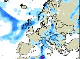
Click here for details of the weather over the next few days.
Please note that forecasting beyond five days is notoriously difficult, and small errors at short-range can lead to large deviations further in time. Our longer-range forecasts are based on the most accurate weather data available at the time, but alterations may be required as the period progresses. Please check back regularly for the most up-to-date forecast run.
Wednesday 15/06/05 to Thursday 16/06/05
Wednesday will be dry across southern parts of England and Wales, as high pressure to the south keeps conditions settled. It will feel warm in the sunshine, with generally light winds. However, a complex low to the north of Scotland is expected to give rather more unsettled conditions elsewhere. Active weather fronts will bring heavy, and perhaps thundery rain across much of Ireland through the day. Lighter, more showery rain will also affect northern and western Scotland. This rain will spread southwards to northern England and north Wales, after a dry start to the afternoon. For those in the south-east praying for rain, Thursday won't come as good news. The rain in western areas will become stuck across south-west England, Wales and northern England, allowing the Midlands, southern and eastern England to remain dry and bright. It will become warm here, as winds swing around to the south. Ireland, Northern Ireland and Scotland will have a cool and miserable day, with showery bursts of rain on and off throughout. Winds will also be quite strong here.
 Friday 17/06/05 to Saturday 18/06/05
Weather fronts will finally reach eastern parts of England on Friday, but they will be very weak and fragmented, with little in the way of useful rain. Across southern England, it will be rather muggy beneath the cloud, with temperatures reaching up to 24C. The rest of the UK will be fresher, with morning cloud clearing to give some sunny spells. A few showers are likely across Scotland and Northern Ireland though, and later in the afternoon, freshening winds will bring rain into western parts of Ireland as the next depression moves in. On Saturday, the very warm weather will continue across southern parts of England and Wales, and by now temperatures could be up to 25 or 26C. Most of England and Wales will be dry too, with the best of the sunshine in the south and east. For most of Ireland and Scotland, it will be cooler and cloudier with outbreaks of rain. The rain could be heavy during the morning, but it should tend to ease and fragment during the afternoon. Breezy here, with the winds freshening again later.
 Sunday 19/06/05 to Monday 20/06/05
There will be very little change on Sunday, with the very warm and settled conditions continuing in the south of the UK. However, the afternoon highs may just trigger one or two sharp showers. For Northern Ireland and Scotland, a similar story of cloudy skies and outbreaks of rain, perhaps becoming heavy again in the afternoon. Ireland should have a better day though, with any rain becoming confined to the far north. Confidence for the start of next week is currently very low, due to the complex timings and development of low pressure to the south of the UK. However, it does seem likely at present that a thundery breakdown will take places across southern areas, after the recent sunny, warm weather. Conversely, the north and west will become brighter and cooler, with morning rain clearing eastwards. Please check back for further forecast updates.