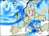
Long-range Outlook: 15/04/05 - 20/04/05
Sunshine & showers, or longer spells of rain.
Click here for details of the weather over the next few days.
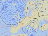
Please note that forecasting beyond five days is notoriously difficult, and small errors at short-range can lead to large deviations further in time. Our longer-range forecasts are based on the most accurate weather data available at the time, but alterations may be required as the period progresses. Please check back regularly for the most up-to-date forecast run.
Friday 15/04/05 to Saturday 16/04/05
We're expecting a ridge of high pressure to affect much of the UK during Friday, giving many areas some decent sunny spells. However, there will be a light northerly wind around the high, so the air will not be particularly warm. In fact, during Friday morning parts of Scotland and northern England may well wake to a frost. Eastern England will start rather cloudy, but will join the rest of England and Wales with some warm afternoon sunshine. At the same time, freshening south-west winds will spread cloud into western Scotland and Northern Ireland, with rain here by evening. This rain will move eastwards through Ireland overnight, reaching western parts of England and Wales by Saturday morning. Central and eastern England is likely to start Saturday dry and sunny, but even here the cloud will thicken during the afternoon. Any rain arriving here towards evening is likely to be light at patchy, whilst the morning's rain across western England, Wales, Scotland and Northern Ireland clears to showers. Mild initially, but turning cooler with fresh westerly winds as the rain moves through.
 Sunday 17/04/05 to Monday 18/04/05
Sunday will start promising enough for much of England, Wales and eastern Scotland, with some morning sunshine. However, a small but intense depression will swing in from the west during the afternoon, giving an unsettled end to the day. South-westerly winds will become strong at times across Ireland, Northern Ireland and western Scotland in the morning, as heavy rain sweeps in from the Atlantic. As the rain moves east into Wales, eastern Scotland and western parts of England, there could even be some thunder. Winds will be extremely gusty as the active cold front moves through, although the far south-east could stay dry until late afternoon. Turning colder behind the rain, with blustery showers in western areas. With low pressure becoming established to the west of Scotland during Monday, all areas can expect a typical day of April showers. The showers will start the day in western areas, but will develop or move eastwards to most places later. Many will be heavy, with hail and thunder, perhaps falling as snow over the Highlands. Feeling cool in strong westerly winds.
 Tuesday 19/04/05 to Wednesday 20/04/05
Winds will strenghten once again on Tuesday, as another spell of wet weather sweeps into western parts of Scotland, together with much of Ireland during the morning. Once again, some of the rain will be heavy, although it should clear through to sunshine and showers quite readily. The opposite will be true for England and Wales, as morning sunshine once more gives way to cloud and spells of rain for the afternoon. However, rain amounts will be fairly sparse where it's most needed, and some parts of south-east England will see very little. Wednesday will be back to a straight-forward run of sunshine and showers. These will always be heaviest and most frequent in the north and the west, often with hail and thunder, and merging to give prolonged spells of heavy rain later in western Scotland. With fresh westerly winds, it will remain on the cool side, but in any shelter from the wind, and in the sunny spells, it will feel quite spring-like. Please check back for further forecast updates.