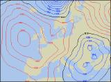
Long-range Outlook: 16/02/05 - 21/02/05
Becoming milder for a time. A lot of cloud around.
Click here for details of the weather over the next few days.
Please note that forecasting beyond five days is notoriously difficult, and small errors at short-range can lead to large deviations further in time. Our longer-range forecasts are based on the most accurate weather data available at the time, but alterations may be required as the period progresses. Please check back regularly for the most up-to-date forecast run.
Wednesday 16/02/05 to Thursday 17/02/05
Wednesday will be dominated by an area of high pressure, sitting close to the coast of Ireland. However, this will be a rather cloudy high, as weather fronts become trapped and slowly decay within it. Ireland and Northern Ireland will become a little brighter in the afternoon, after a cloudy morning. Eastern England will also be bright after a morning frost. The rest of England and Wales will be mostly cloudy with patchy rain, and this rain will be more persistent across Scotland through the afternoon. With the high pressure remaining to the west of the UK and Ireland, there won't be much change in the weather during Thursday. Most places will have plenty of cloud, but on the whole it will be dry with occasional brightness. The exception will be eastern Scotland and eastern England, as weak weather fronts encourage cloud and drizzle to topple southwards along North Sea coasts. Mild in most places.
 Friday 18/02/05 to Saturday 19/02/05
Friday's weather will remain benign and settled, with anticylonic weather prevailing. As the high builds from the west, there will be less in the way of cloud across both the UK and Ireland. Whilst this means more sunny spells by day, there is also the potential for a frost as it turns chilly overnight. Throughout the day though, western Scotland and parts of Northern Ireland can expect to see rather grey skies as cloud develops off the sea. It's looking like Saturday will see very similar weather, although with a few exceptions. Ireland and Northern Ireland will be dry with occasional sunshine, as will Wales and western parts of England. Across Scotland and eastern England, increasing northerly winds will drag in thicker cloud and occasional bursts of showery rain. Most of this will be light, but it will begin to feel colder here once again.
 Sunday 20/02/05 to Monday 21/02/05
The second part of the weekend is currently rather uncertain, as models indicate that the high will degrade westwards back into the Altantic. This will open the door for colder northerly winds to return, with plenty of cloud and rain spreading southwards across the country. The best of the drier weather will be across Ireland, and the rain or showers will turn wintry across Scotland later. Details for Monday are difficult to pinpoint, but there is the potential for a much colder spell of weather to return. The risk of snow will always be highest across Scotland and north-east England, but with any embedded troughs spreading southwards, many areas could see wintry showers during the day. For more detail on the weather during next week and beyond, please check back for further forecast updates.