Long-range Outlook: 16/08/04 - 21/08/04
A rather unsettled outlook, with rain at times.
Click here for details of the weather over the next few days.
Please note that forecasting beyond five days is notoriously difficult, and small errors at short-range can lead to large deviations further in time. Our longer-range forecasts are based on the most accurate weather data available at the time, but alterations may be required as the period progresses. Please check back regularly for the most up-to-date forecast run.
Monday 16/08/04 to Tuesday 17/08/04
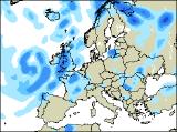
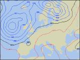
The start of next week looks set to be rather unsettled, with low pressure across northern areas of the UK. This will give frequent and at times, heavy showers across many parts, especially across Scotland and northern England. During the afternoon, a band of more persistent rain will move eastwards to affect the western side of Ireland and Northern Ireland. Cloudier skies and heavy, persistent rain will also threaten southern England for much of the day. Temperatures around average everywhere. A very transient ridge of high pressure will move from west to east across the country on Tuesday, but it really will be a fleeting event. Conditions will become largely dry during the morning and first part of the afternoon, with some sunshine across northern parts. However, the rain will never be too far away from southern England, and yet more weather fronts will sweep across Ireland, giving outbreaks of rain and freshening winds during the afternoon.
 Wednesday 18/08/04 Thursday 19/08/04
It is expected to become much warmer on Wednesday, as a deepening area of low pressure out west encourages a strong southerly flow ahead of it. Across central and eastern England, temperatures may reach the high twenties Celsius in the sunshine, but slow-moving weather fronts across Ireland will give heavy rain here. During the afternoon, this rain will move eastwards to affect parts of Wales, western Scotland and south-west England. A few thunderstorms are likely across southern England too by evening. South-east England may just cling on to the warm, humid conditions on Thursday, but elsewhere it will be mostly cloudy with outbreaks of rain. Some of the rain will be heavy with the risk of thunder here and there, especially across northern parts where any more rain will be rather unwelcome. During the afternoon, brighter skies with scattered showers will move across Ireland, and other western parts of the UK, as rain becomes confined to central and eastern areas.
 Friday 20/08/04 Saturday 21/08/04
On Friday, the heavy and thundery rain will finally clear away from eastern parts, and as low pressure transfers into the North Sea, a cooler and fresher north-westerly airflow will affect most places. There will be some pleasant sunshine around, especially during the afternoon, but also one or two showers. The heaviest, most frequent showers will be across Scotland and Northern Ireland, with southern parts of the country turning mostly dry. The weekend is currently looking to be an unsettled one, with outbreaks of showery rain in many places on Saturday. This weather will continue on Sunday across most places. However, there's every chance that high pressure will begin ridging into the south-west of the UK, turning conditions brighter and more settled here in the afternoon. Please check back for further forecast updates.