Long-range Outlook: 17/01/06 - 22/01/06
Rain at first. Colder for a time.
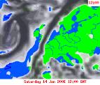
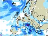
Click here for details of the weather over the next few days.
Please note that forecasting beyond five days is notoriously difficult, and small errors at short-range can lead to large deviations further in time. Our longer-range forecasts are based on the most accurate weather data available at the time, but alterations may be required as the period progresses. Please check back regularly for the most up-to-date forecast run.
Tuesday 17/01/06 to Wednesday 18/01/06
Tuesday is now looking cloudier and more unsettled, with spells of rain clearing from eastern England and eastern Scotland during the day. Behind the rain across the rest of the UK and Ireland, it will turn brighter with some sunshine, but also colder. Brisk northerly winds will blow in showers across Northern Ireland, western Scotland and other western coasts of England and Wales, and some will be a touch wintry on the hills. By Wednesday, eastern parts of England and Scotland will still be rather cloudy with a few spots of rain, and it will be chilly here. Another spell of rain will reach western Scotland and much of Ireland through the afternoon, as south-westerly winds increase. For remaining parts of England and Wales, together with southern parts of Ireland, it will be drier with occasional brightness, but there will always be a lot of cloud. Becoming milder in the west.
 Thursday 19/01/06 to Friday 20/01/06
High pressure is expected to build across Scandinavia once again on Thursday, and with low pressure across France, this will encourage an easterly wind across the North Sea. As a result, central and eastern England will have a cold but bright day, with occasional sunny spells. Further west across southwest England, Wales and the Irish Republic, it will be cloudier with rain at times, gradually dying out later. It will still be mild across Northern Ireland and Scotland, with strong southerly winds blowing in cloud and rain for much of the day. Perhaps turning drier in eastern Scotland later. There is a large amount of model variability by Friday, so confidence is fairly low for the extended outlook. However, indications are that a cold easterly wind will set in, as high pressure continues to dominate northern Europe. These easterly winds will blow in very isolated wintry showers to eastern coastal areas, but the vast majority of England, Wales and Scotland will be dry and cold, with a lot of low cloud and some sunshine in the west. Thicker cloud will give a risk of rain across Ireland, and perhaps western Scotland.
 Saturday 21/01/06 to Sunday 22/01/06
The weekend is currently looking like starting cold, but gradually turning milder. Easterly winds will persist during Saturday, blowing in cold air and a lot of low cloud. The best of any sunny spells will be in western parts of the UK, in particular across southwest England, west Wales and northwest England. Later in the afternoon, rain will reach western parts of Ireland and Northern Ireland. On Sunday, winds will swing round to a south or southeasterly direction, so it won't feel as cold. Fronts will continue to plague parts of Ireland and Northern Ireland, giving patchy rain and drizzle. Through the latter part of the afternoon, this rain will turn heavier here, as milder air eventually floods in from the west. Confidence is low for the latter part of next week however, so please check back for further forecast updates.