Long-range Outlook: 17/07/05 - 22/07/05
High pressure returning. Warm sunshine.
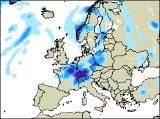
Click here for details of the weather over the next few days.
Please note that forecasting beyond five days is notoriously difficult, and small errors at short-range can lead to large deviations further in time. Our longer-range forecasts are based on the most accurate weather data available at the time, but alterations may be required as the period progresses. Please check back regularly for the most up-to-date forecast run.
Sunday 17/07/05 to Monday 18/07/05
High pressure will remain close-by to southern and western parts of the UK and Ireland on Sunday. As a result, most of Ireland, south-west England and Wales will be dry with some sunshine, especially inland. The rest of England will also be dry, with occasional brightness, but also a lot of cloud. Across the far north of England, this cloud could be thick enough for patchy rain. Across most of Northern Ireland and Scotland, weather fronts will give essentially cloudy conditions with outbreaks of rain and drizzle. Most of the rain will be over west-facing coasts and hills. Winds will be light, although a fresh westerly will develop across Scotland. Cloud and occasional rain will continue across Scotland and Northern Ireland during Monday, perhaps with further wet weather spreading eastwards across the Irish Republic later. The rest of England and Wales will be mainly dry, with some brightness across north Wales and the Midlands. Later in the afternoon, weather fronts spreading up from the south may give showery spells of rain across southern England.
 Tuesday 19/07/05 to Wednesday 20/07/05
It's looking increasingly likely that high pressure will become established to the west of Ireland on Tuesday, with moderate northerly winds across most of the UK and Ireland. It will be dry with some sunshine across Ireland and Northern Ireland, and this will spread to Scotland and northern England after a cloudy start. Cloud will also break across a large part of England and Wales to give some brightness, although North Sea coasts of England will hold on to a lot of low cloud. There is just the slight risk of some thundery rain spreading north-east from France, getting into the extreme south-east of England by evening. The high will move further east during Wednesday, becoming centred over the UK through the day. As a result, it will be dry just about everywhere, with some decent spells of sunshine. Once again, a lot of low cloud may continue to affect north-east Scotland and North Sea coasts of England. Generally warm, perhaps turning very warm across England and Wales with light winds.
 Thursday 21/07/05 to Friday 22/07/05
On Thursday, there will be very little change in the weather, with some decent sunny spells for most of the UK and Ireland. The best of the sunshine will be across central and southern parts of England and Wales, and this will be reflected in the highest temperatures. A light northerly drift will continue to give low cloud across North Sea coasts, but even this should break up. Later in the day, thickening cloud will spread patchy drizzle to northern and western Scotland. The high pressure is expected to retreat westwards during Friday, allowing weak weather fronts to topple in from the north-west. These will bring a lot of cloud to Scotland and eastern England, with occasional rain and drizzle. The best of any remaining sunshine will be across Ireland, as well as south Wales and south-west England. As ever, please check back for further forecast updates.