Weekly Outlook : 14/07/03-20/07/03
A Sizzling Start. Thundery Breakdown Midweek.
 Monday 14/07/03 to Tuesday 15/07/03
A clear, sunny morning across England and Wales, with little if any cloud around. Generally fine across much of Scotland also, but a few showers are expected in the west. Ireland and Northern Ireland will see bright spells but also some scattered showers, possibly thundery. A sizzling afternoon across the mainland UK, with highs exceeding 30C in places. Showers in the west dying out on the whole, although feeling rather cooler here. Clear skies for many overnight, although by early Tuesday cloudier skies will spread into the south-west. These will introduce some thundery showers, spreading north to western Wales, parts of Ireland and Northern Ireland, and also eastwards along the south coast, as far as the Isle Of Wight by evening. Everywhere else, another hot, sunny day with temperatures similar to those on Monday, although cooler in the west.
 Wednesday 16/07/03 to Thursday 17/07/03
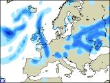
A breakdown well underway during Wednesday, with cloudy skies across many southern and western parts. Coupled with the high temperatures, some torrential downpours and thunderstorms are expected in these parts, with local flooding possible. Remaining hot and sunny from North Wales northwards, although a keen easterly wind will keep the east coast considerably cooler. Thunderstorms rumbling slowly north overnight, and by Thursday morning heavy rain will have reached northern England. To the south of this, some further heavy showers with thunder at times. Feeling slightly cooler, although still warm with more of a south-westerly breeze. Much of Ireland will remain overcast with some heavy rain, local flooding possible. Rain/thunder in many parts overnight, and feeling fresher.
 Friday 18/07/03 to Sunday 20/07/03
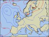
During Friday, much of England and Wales are expected to have a dry, sunny day, and once early cloud clears to the north Scotland will join the rest of mainland Britain. Across Ireland however, cloudier skies once more with outbreaks of rain, some heavy. Cool here, but still warm elsewhere with temperatures in the mid twenties Celsius. Low pressure to the east and high pressure to the west looks set to maintain this split over the weekend, but with southerly winds it will always be on the warm side. Plenty of sunny spells for the weekend across England, Wales and eastern Scotland. Further cloud and occasional rain in the west however, sometimes heavy. This situation depends heavily on the progress of the earlier breakdown however, so forecasts may alter in accordance with this in the next forecast update.