Long-range Outlook: 18/10/05 - 23/10/05
Rain for most. Briefly cold.
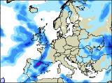
Click here for details of the weather over the next few days.
Please note that forecasting beyond five days is notoriously difficult, and small errors at short-range can lead to large deviations further in time. Our longer-range forecasts are based on the most accurate weather data available at the time, but alterations may be required as the period progresses. Please check back regularly for the most up-to-date forecast run.
Tuesday 18/10/05 to Wednesday 19/10/05
We're still expecting a line of heavy, slow-moving rain to affect Ireland and Northern Ireland on Tuesday, as a cold front attempts to move in from the west. However, the large, blocking area of high pressure over Scandinavia will prevent the rain travelling very far. As a result, most of England, Wales and Scotland can expect a dry day, with the best of any sunshine in central and eastern areas. Towards evening, there is the risk that rain will reach south-west England though, and western coasts of England and Wales will be rather grey and misty all day. Staying mild, in fresh south to south-easterly winds across the country. On Wednesday, an area of low pressure will deepen as it reaches western Scotland, bringing with it strong to gale force south-westerly winds here. As well as the winds, outbreaks of heavy rain will set in across Ireland, reaching northern England and Wales by evening. The rest of England will see the overnight band of rain clearing during the morning, leaving some brightness for a time, but it will cloud over again later.
 Thursday 20/10/05 to Friday 21/10/05
Wednesday's low pressure won't have moved far at all by Thursday, maintaining strong winds in north-western parts of the UK. Outbreaks of rain will affect central and southern England during the morning, some heavy, and accompanied by a strong and gusty wind. This rain will become restricted to south-east England in the afternoon though. However, an occlusion will mean the return of heavy rain across western Scotland and Northern Ireland, with a risk of gales again. Once the morning rain clears, the rest of Ireland, England and Wales will become dry with sunny spells through the afternoon. Overnight rain will clear from eastern parts of England first thing on Friday, leaving the UK and Ireland in a sunny but showery north-westerly flow. Heavy and frequent showers will set in across northern and western Scotland, Northern Ireland, north-west England and north Wales, with a risk of hail and thunder. Elsewhere, there will be fewer showers, and more sunny spells. Feeling much cooler everywhere in the brisk north-westerly wind.
 Saturday 22/10/05 to Sunday 23/10/05
On Saturday, cold northerly winds will bring frequent showers to northern and eastern Scotland, as well as eastern coasts of England. These showers will turn a touch wintry over the higher ground in Scotland, with hail in places at lower levels. Elsewhere across the UK, it will be a dry day with some sunny spells, after a chilly start. However, another area of low pressure will spread cloud and rain across much of Ireland through the afternoon and evening. Feeling chilly everywhere, especially in the wind. Current indications for Sunday are showing high pressure building in from the north-west, giving many northern and western parts of the UK and Ireland a dry but chilly day, with some sunshine. However, spells of rain are likely to continue across central and southern parts of the UK, as weather fronts become slow-moving. For more details on the weather for next week and beyond, please check back for further forecast updates.