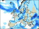
Long-range Outlook: 17/12/04 - 22/12/04
Fairly mild with rain at times. Colder later.
Click here for details of the weather over the next few days.
Please note that forecasting beyond five days is notoriously difficult, and small errors at short-range can lead to large deviations further in time. Our longer-range forecasts are based on the most accurate weather data available at the time, but alterations may be required as the period progresses. Please check back regularly for the most up-to-date forecast run.
Friday 17/12/04 to Saturday 18/12/04
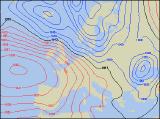
Unsettled conditions will have firmly returned to all parts by Friday, as a deep area of low pressure to the north of Scotland dictates our weather. With strong north-west winds, frequent showers will affect northern and western Scotland, turning to snow over the hills, but south-east Scotland will remain mostly dry. At the same time, a waving weather front will give outbreaks of heavy rain across much of England, Wales and Ireland, although northern England should stay drier and a little brighter. The weather will be more straight-forward on Saturday, as north-west winds affect all parts. Showers will be heaviest and most frequent across Scotland and Northern Ireland, where they will again be of snow over the hills, with rain and hail at lower levels. Most of England and Wales will stay dry with some sunny spells, although thicker cloud with patchy rain will plague the south-west. This rain will also return across the Republic of Ireland through the evening.
 Sunday 19/12/04 to Monday 20/12/04
On Sunday, another area of low pressure will wind itself up and move in towards north-west Scotland. Associated weather fronts will give outbreaks of rain across much of Northern Ireland, Scotland and northern England through the day, heavy at times. The rest of England and Wales, together with a large part of the Irish Republic, will remain dry with some sunshine, although it'll turn increasingly hazy through the day. By Monday, a straight run of north-westerly winds will have returned across most places. Resultant showers across Northern Ireland and Scotland will become heavy through the day, with a risk of hail and thunder. Showers will also affect north-west England and north Wales, although there will be some lengthy sunny spells. The best of the drier and brighter weather will be across southern England and south Wales, and also across southern parts of Ireland which will be closest to high pressure.
 Tuesday 21/12/04 to Wednesday 22/12/04
In the run up to the Christmas period, the weather is currently looking rather unsettled, wet and windy. Tuesday will see more weather fronts sweeping in from the west, bringing with them outbreaks of heavy rain. Southern and eastern England should remain dry until evening though. On Wednesday, the rain will clear away from southern areas, allowing north-westerly winds to race across all parts. These will introduce colder weather, with plenty of showers developing. Most of these will be across Scotland and Northern Ireland, where there'll turn readily to snow over the hills. But wiill the weather become more festive over the Christmas period? To find out our current thoughts of whether this Christmas will be white, visit here, and please check back for further forecast updates.