Long-range Outlook: 19/07/04 - 24/07/04
Unsettled at first. Sunny and warm in the south later next week.
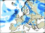
Click here for details of the weather over the next few days.
Please note that forecasting beyond five days is notoriously difficult, and small errors at short-range can lead to large deviations further in time. Our longer-range forecasts are based on the most accurate weather data available at the time, but alterations may be required as the period progresses. Please check back regularly for the most up-to-date forecast run.
Monday 19/07/04 to Tuesday 20/07/04
Models are currently indicating that much of England and Wales will have a small taste of summer on Monday. Although there will be quite a lot of cloud floating around, it should stay dry with some warm periods of sunshine. Conditions won't be all that bad across Ireland and Scotland either, with some sunshine here too. However, there'll also be a scattering of showers, heaviest across north-west Scotland where the south-west winds will become fresh later. Conditions will go rapidly downhill across Ireland and Northern Ireland on Tuesday, as cloudy skies bring outbreaks of heavy and persistent rain, together with a brisk southerly wind. This rain will get into western parts of Scotland and west Wales during the afternoon. Ahead of this, across much of England, eastern Scotland and east Wales, some very warm air will be dragged up from the south, giving a rather humid day. However, it should remain dry with some sunshine, and only isolated showers.
 Wednesday 21/07/04 to Thursday 22/07/04
On Wednesday, the very warm and humid air looks like staying put across south-east England, but with the increasing risk of scattered downpours. Across the rest of the UK, it will be rather cloudy with showery bursts of rain, some heavy with the risk of thunder. Through the afternoon, brighter, fresher weather will spread eastwards across western Scotland, Ireland and Northern Ireland, but with a few showers. This cooler air will eventually reach even eastern parts of England by Thursday, but not before a band of showery rain, some heavy, spreads north-eastwards. Behind this, there will be a mixture of sunny spells and scattered showers, with Scotland and Ireland always seeing the heaviest. Winds will become fresh once more, from a south-westerly direction.
 Friday 23/07/04 to Saturday 24/07/04
At present, it looks as if summer may return to southern parts, with high pressure building in from the south-west on Friday. This means a spell of fine, sunny weather for much of Ireland, Wales, and central and southern England, and it will become pleasantly warm. Across Northern Ireland, Scotland and northern England, there will be more in the way of cloud around with showery bursts of rain during the day, some heavy. Across southern parts on Saturday, summer will be well and truely in place, with some of the warmest temperatures so far in July. Long spells of sunshine will continue across England, Wales and Ireland, with this continuing into Sunday. However, Scotland and Northern Ireland will not be so lucky, as there will be a good deal of cloud here with occasional rain. As ever, please check back for further forecast updates, and the possibility of the return of summer!