Long-range Outlook: 18/10/04 - 23/10/04
Often wet and chilly with rain or showers.
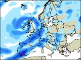
Click here for details of the weather over the next few days.
Please note that forecasting beyond five days is notoriously difficult, and small errors at short-range can lead to large deviations further in time. Our longer-range forecasts are based on the most accurate weather data available at the time, but alterations may be required as the period progresses. Please check back regularly for the most up-to-date forecast run.
Monday 18/10/04 to Tuesday 19/10/04
England and Wales will have a fairly bright start to the day on Monday, although there will be patchy fog around, and it will otherwise be rather cloudy. Across Ireland and western Scotland, outbreaks of rain and freshening winds will spread in from the west, with some heavy bursts at times. This will move eastwards into eastern Scotland, and much of England and Wales by afternoon, with sunshine and blustery showers following to Northern Ireland and western Scotland. Becoming rather chilly in most places. Rain may be slow to clear across south-east England on Tuesday, and it will also return to much of Scotland during the day. Elsewhere, with low pressure dominating the scene, there will be plenty of heavy showers, some with hail and thunder, and potentially turning wintry over the highest ground across northern England. There will be some sunny spells between the showers, but with fresh to strong west to north-west winds, it will still feel chilly everywhere.
 Wednesday 20/10/04 to Thursday 21/10/04
Current predictions for Wednesday are a little uncertain, and depend on the development of further areas of low pressure. However, it does look like a developing depression will sweep heavy rain across much of central and southern England, and south Wales on Wednesday, perhaps with thunder in places. Across the rest of the UK and Ireland, it will remain blustery and chilly with very occasional sunny spells and plenty of heavy showers. With low pressure to the west of the UK on Thursday, winds will turn more south-westerly, and thus it won't feel as cold across most places. There will be some sunny spells, especially across eastern parts of England at first on Thursday. Elsewhere, it will be rather cloudy with occasional showers, and these will merge to give longer spells of rain during the afternoon. The heaviest of these will be across Ireland, Northern Ireland and western Scotland, together with Wales and south-west England later.
 Friday 22/10/04 to Saturday 23/10/04
On Friday, there is the potential for some nasty weather to cross the UK from the west. This will be in the form of heavy, driving rain, giving very gusty and squally conditions in many places. There is also the risk of hail and thunder as the weather front moves in central and eastern parts of the country, although it should move through pretty quickly. Behind this, to the west, it will become much brighter, but much colder with showers falling as hail in places, and turning wintry over the mountains. All parts will be in a fresh north-westerly airflow on Saturday, and this will make it feel very chilly. The best of the sunny spells will be in southern and eastern areas, once early cloud has cleared. Elsewhere, there will be lots of heavy showers, some with hail and thunder, and it will become very blustery as they come along. Sunday is looking rather similar, with sunny spells and showers, and it will remain on the cold side.