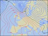
Long-range Outlook: 20/01/05 - 25/01/05
Cold with wintry showers. Milder again later.
Click here for details of the weather over the next few days.
Please note that forecasting beyond five days is notoriously difficult, and small errors at short-range can lead to large deviations further in time. Our longer-range forecasts are based on the most accurate weather data available at the time, but alterations may be required as the period progresses. Please check back regularly for the most up-to-date forecast run.
Thursday 20/01/05 to Friday 21/01/05
High pressure across France, and low pressure to the north of Scotland is expected to give a strong westerly flow across the UK and Ireland on Thursday. There will be some sunny spells in southern parts of England and Ireland, but elsewhere it will be rather cloudy with patchy rain. Heavier and more persistent rain will affect Scotland and Northern Ireland during the afternoon, where westerly gales are likely. The rain will turn to snow above about 250-300m. On Friday, the winds will turn north-westerly, bringing in colder air to most of the UK once again. Outbreaks of rain across England and Wales during the morning will clear away southwards, leaving bright or sunny spells for all. However, showers will blow in on the fresh wind, especially across Scotland, Northern Ireland, northern England and north Wales. There is a risk of hail and thunder, and snow will fall to increasingly low levels across Scotland towards evening.
 Saturday 22/01/05 to Sunday 23/01/05
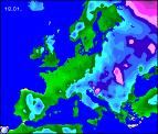
Saturday will become even colder, as the north-westerly wind swings around to a northerly direction. Sleet and snow showers will fall to sea-level across Scotland, perhaps even northern England and Northern Ireland through the afternoon. After a frosty start, there will be plenty of wintry sunshine across England and Wales. However, wintry showers will blow in across north and west Wales, as well as the Midlands. Some will drift down the east coast into East Anglia later too. High pressure will build across Ireland on Sunday, giving a largely dry and bright day with sunny spells, after a frosty start. Much of England, Wales and southern Scotland will be dry and sunny too, although there will be exceptions. Eastern England will have scattered sleet showers, falling as snow over the hills in north-east England. Northern Scotland will have more frequent snow showers, with blizzards over the mountains. The northerly winds will gradually ease later.
 Monday 24/01/05 to Tuesday 25/01/05
On Monday, high pressure is expected to be dominating the weather right across the UK and Ireland. It will be a cold and frosty start, but the day will remain dry with plenty of sunshine. Later in the afternoon, freshening south-westerly winds will drag more cloud into western parts of Ireland and Northern Ireland, heralding rain after dark. This rain will affect much of Ireland throughout Tuesday, reaching western parts of England, Wales and Scotland through the afternoon. However across eastern England and eastern Scotland, it will be a largely dry day with sunny spells, and gradually increasing cloud. Much milder by this time, but as ever, please check back for further forecast updates.