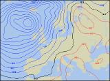
Long-range Outlook: 21/03/05 - 26/03/05
Mild, but unsettled with rain or showers.
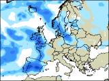
Click here for details of the weather over the next few days.
Please note that forecasting beyond five days is notoriously difficult, and small errors at short-range can lead to large deviations further in time. Our longer-range forecasts are based on the most accurate weather data available at the time, but alterations may be required as the period progresses. Please check back regularly for the most up-to-date forecast run.
Monday 21/03/05 to Tuesday 22/03/05
Monday is expected to set the tone for next week, with low pressure never to far away. Outbreaks of rain in eastern England on Monday morning will soon clear away, leaving much of England and Wales dry with some sunny spells, and just a few showers. However, more weather fronts will spread cloud and rain in across Ireland and Northern Ireland during the afternoon, the rain heavy at times. The initial rain will never really clear from Scotland, and whilst western areas may have some brighter interludes, the east will remain cloudy and wet. Temperatures will be a little above average everywhere. Tuesday is expected to be a repeat performance, with heavy rain sweeping across all areas during the morning, clearing to leave England and Wales brighter in the aftenoon. Once again though, the rain will linger across Scotland for much of the day. Early brightness across Ireland and Northern Ireland will soon disappear as heavy rain spreads from the west during the day, reaching western coasts of England and Wales towards the end of the afternoon. Still relatively mild everywhere.
 Wednesday 23/03/05 to Thursday 24/03/05
Wednesday is expected to be a more straight-forward day of sunshine and showers. With fresh south-westerly winds, most of the showers will be across Ireland, together with western parts of England and Wales. However, after a mostly sunny morning across the rest of England, cloud will bubble up allowing a few heavy, possibly thundery downpours to develop around the middle of the afternoon. Scotland will see the best of the driest weather, although showers are likely in western areas for a time. Temperatures still above average, and it will feel pleasant in the sunshine. Thursday is currently looking rather more concerning, as a small yet intense area of low pressure speeds its way across the country. For a time, southerly winds across exposed parts of England and Wales could reach gale force, before easing later. Rain will be extensive across Ireland by daybreak, and this will sweep across England and Wales through the afternoon, turning heavier with thunder possible. Once again, Scotland will have the best of the weather, with sunny spells and scattered showers.
 Friday 25/03/05 to Saturday 26/03/05
After a thoroughly wet night across England and Wales, the rain is expected to still be around on Friday morning, with further heavy bursts. However, it should clear away from eastern England through the afternoon, leaving behind sunny spells and scattered heavy showers. Scotland, Northern Ireland and the Irish Republic will have a much brighter day with plenty of sunny spells. Showers will develop from the word go though, some heavy with hail and thunder. Temperatures closer to the seasonal average in brisk westerly winds. With low pressure parked close-by on Saturday, the weather will remain generally unsettled across the whole UK. Most places will have some sunny spells, but everywhere will at least see a few heavy showers, merging to give longer spells of rain at times. On the plus side, it will always be fairly mild, and in the shelter from the wind in the sunshine, it will continue to feel pleasant. Please check back for further forecast updates.