Long-range Outlook: 20/04/05 - 25/04/05
Warm sunshine N&E. Rain S&W later.
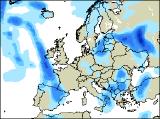
Click here for details of the weather over the next few days.
Please note that forecasting beyond five days is notoriously difficult, and small errors at short-range can lead to large deviations further in time. Our longer-range forecasts are based on the most accurate weather data available at the time, but alterations may be required as the period progresses. Please check back regularly for the most up-to-date forecast run.
Wednesday 20/04/05 to Thursday 21/04/05
After an unsettled start to the new week, Wednesday will see little improvement in our weather. With high pressure to the north and low pressure to the west, a steady south-easterly airflow will continue, although winds will be generally light away from eastern Scotland. Slow-moving weather fronts will give a band of cloud and rain stretching from Northern Ireland and western Scotland, through northern England and the Midlands, to south-east England. Across eastern Scotland, it will be dry with some sunshine, whilst remaining parts of England and Wales will be rather cloudy with scattered showers. More rain will work eastwards across Ireland after a bright morning. If anything, the south-easterly winds will freshen everywhere by Thursday, although any rain across central parts will largely peter out to leave dry but cloudy conditions. The most active rainfall will be across southern parts of Ireland, south-west England and later south Wales, with some heavy bursts. Remaining parts of the UK and Ireland will have some brighter periods, and only isolated light showers.
 Friday 22/04/05 to Saturday 23/04/05
By Friday, the weather will be on the change, with improving conditions for some, and deteriorating conditions for others. High pressure building down from the north is expected to give much of Scotland, northern and eastern England and dry day with warm sunny spells. Although there will be more cloud around, Northern Ireland, Wales and the Midlands will also be dry, bright and reasonably warm. For south-west England and large parts of Ireland, heavy rain will move slowly in from the west, giving a thoroughly miserable end to the day. However, the northward and eastward extent of this rain is currently a little uncertain. On Saturday, low pressure will continue to wind up in the Southwest Approaches, throwing steady and persistent rain further north and east during the day. The rain will cover much of Ireland and Northern Ireland by evening, as well as Wales and south-west England. Some of this will be heavy, and potentially thundery later in the south-west. Elsewhere, another fine day is on the cards, and with decreasing winds it will feel a little warmer.
 Sunday 24/04/05 to Monday 25/04/05
A complex setup is evident by Sunday, and as a result confidence begins to decrease markedly from Sunday onwards. Indications suggest that low pressure will drift across southern England and northern France, bringing with it outbreaks of showery rain across much of central and southern England, as well as Wales. This situation would also bring some fairly strong easterly winds across southern parts of England. Further north across the rest of England and Scotland, it'll stay largely fine with some pleasant sunny spells. Ireland will also have more in the way of sunshine, although scattered sharp showers are likely to develop too. For southern England, Monday will be on a knife-edge as far as the weather goes. France will see the low developing, giving widespread torrential downpours and thunderstorms. These are expected to stay just across the Channel, but there is every chance that some of the downpours may drift into southern counties of England from time to time. Elsewhere, staying mainly dry with some spells of sunshine. As ever, please check back for further forecast updates.