Weekly Outlook : 16/06/03-22/06/03
Warm Start. Turning Cooler & More Unsettled
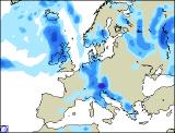
 Monday 16/06/03 to Tuesday 17/06/03
Monday will see glorious weather across England and Wales, with unbroken sunshine in places as high pressure dominates. Temperatures will soar into the high twenties celcius, with sea breezes cooling coastal areas. Much of Scotland will brighten after a cloudy morning with patchy rain, and there will be sunny spells across Ireland also. During the afternoon, cloud will increase in the far west with showery rain likely, this spreading eastwards overnight, but most mainland parts remaining dry and clear. Into Tuesday, it will remain warm or very warm, but turning gradually cooler from the west. This transition will see scattered showers becoming rather widespread into the afternoon, some heavy and thundery. Cloudier skies across western parts will produce more lenghty spells of rain, although it will turn brighter across Ireland later. Eastern parts may just remain dry into the evening, but turning thundery after dark.
 Wednesday 18/06/03 to Thursday 19/06/03
Turning very unsettled on Wednesday, as a deep area of low pressure swings fronts across the UK. Cloud and rain, some heavy will spread across western parts during the early hours, reaching all parts by late afternoon. Showers will follow on to much of Ireland with some bright spells. The winds will be very strong for the time of year, possible gales in the north-west, but generally strong everywhere. Feeling cooler than of late, although temperatures still around average. The strong westerly flow will continue into Thursday, driving showers across many parts, most frequent with thunder in the far north-west. Southern England, Ireland and south Wales are expected to remain mostly cloudy with rain from time to time, and it will feel quite humid here. This rain may spread as far north as Northern England by the end of the day.
 Friday 20/06/03 to Sunday 22/06/03
Staying rather cloudy across southern England on Friday, with rain never too far away, but during the course of the day it will brighten from the south-west. Sunshine and blustery showers continuing across northern and western parts, the showers heavy at times. Strong to gale force winds will continue to affect Northern Ireland and northern Scotland. The Midlands, eastern England and much of Wales will remain dry with only scattered showers. The weekend looks set to see a return to high pressure and more settled conditions. Sunshine will increase, thus lifting temperatures into the mid-twenties celcius by Sunday. However, fronts will plague north-western parts with rain from time to time, and it will remain on the breezy side here for much of the weekend. Further updates in the next weekly forecast.