Long-range Outlook: 21/01/06 - 26/01/06
Dry South & East. Damp North & West.
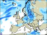
Click here for details of the weather over the next few days.
Please note that forecasting beyond five days is notoriously difficult, and small errors at short-range can lead to large deviations further in time. Our longer-range forecasts are based on the most accurate weather data available at the time, but alterations may be required as the period progresses. Please check back regularly for the most up-to-date forecast run.
Saturday 21/01/06 to Sunday 22/01/06
There's good agreement between forecast models, that Saturday will be dominated by high pressure across the southern half of the UK and Ireland. Therefore, for most of England and Wales, it will be dry with some sunny spells developing. Similar conditions are expected across the Irish Republic, although with more cloud around. For Northern Ireland and Scotland, skies will be generally cloudy. Across western and northern areas, patchy rain or drizzle will continue on and off through the day. Staying mild across all areas, although rather chilly in the south first thing. On Sunday, the high looks set to retreat eastwards into the North Sea. This will allow fronts across northern parts of the UK, to spread slowly southeast. As a result, showery bursts of rain will affect Northern Ireland, togther with northern parts of the Irish Republic. At the same time, a spell of rain will spread south through Scotland, into northern England during the afternoon. Further south across the rest of England, Wales and the Irish Republic, it will remain dry but with increasing amounts of cloud.
 Monday 23/01/06 to Tuesday 24/01/06
The start of the new week will see a north-south split continue on Monday, with high pressure keeping settled conditions across southern areas, whilst more cloud and rain sweep across the north. The rain will affect Northern Ireland and Scotland predominantly, always heaviest and most persistent in western areas. Northern England, north and west Wales, together with the Irish Republic will be cloudier, but essentially dry. The best of any sunny spells will be across the rest of England and Wales. Mild or very mild across the north, although temperatures will be around average in the south. If anything, the high pressure looks set to build further during Tuesday, with dry and bright conditions extending northwards to much of Scotland. Sunshine amounts won't be great, with banks of cloud floating around. It will become chillier in eastern areas, with more of a continental drift developing. Western parts of Ireland will have cloudier skies, and with freshening southerly winds, there may be some patchy light rain around during the afternoon.
 Wednesday 25/01/06 to Thursday 26/01/06
Forecast models deviate sharply by mid-week, thus forecast confidence rapidly drops off for Wednesday. However, for much of the UK, it is currently looking dry with occasional sunny spells, and a continuing trend to chillier conditions in southern and eastern parts of the UK. Further west across Ireland, with southerly winds and fronts never to far away, it will be milder and rather cloudy here. Very little change is expected on Thursday, with patchy rain across Ireland, and predominantly dry conditions across the rest of the UK. There are hints that, towards the end of Thursday, a colder south-easterly wind will develop, heralding much colder weather in the extended outlook. However, for more details on this, please check back for further forecast updates.