The week ahead
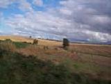
Changeable
Forecast valid for Sunday 19/05/02 to Saturday 25/05/02 TOI Thursday 16/05/02 2000 BST. Based on MRF, ECMWF, UKMO, and ENS labelled model.
High confidence at 80% for another changeable week with little sign yet of a prolonged and warm settled spell. It is unlikely at 10% confidence that any place in the British Isles will remain completely dry for more than 48 hours next week, highest chance of dry weather will be in southeast England at the beginning and end of the week.
 Any thundery weather will have cleared all parts by Sunday morning and most places will start mainly cloudy and rather cool. In northern and central parts some light rain is likely but sunny intervals will develop during the day. The south looks like being mainly dry with sunny spells by the afternoon with temperatures around average.
The weather for the rest of the week can best be described as changeable and on the whole temperatures will be around average in the low to upper teens centigrade range. Low pressure to the west of Scotland on Monday will transfer into the British Isles during Tuesday bringing rain or showers to all parts. Midweek is looking particularly unsettled when some torrential downpours are possible with hail and thunder locally, particularly over northern England, Wales and the Midlands. Winds will be generally light or moderate and variable in direction. The end of the week should become drier, particularly in the southwest as pressure starts to rise.
Outlook for the following week with low confidence is for the weather to remain on the cool side with more rain at times, particularly in northern areas.
This forecast has been prepared personally by Will Hand who will take no responsibility whatsoever for any matters arising from the use of information provided.