Long-range Outlook: 20/12/04 - 25/12/04
Mild at first. Chance of snow in north later.
Click here for details of the weather over the next few days.
Please note that forecasting beyond five days is notoriously difficult, and small errors at short-range can lead to large deviations further in time. Our longer-range forecasts are based on the most accurate weather data available at the time, but alterations may be required as the period progresses. Please check back regularly for the most up-to-date forecast run.
Monday 20/12/04 to Tuesday 21/12/04
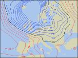
The weather during the run up to Christmas is proving very reluctant to give up any secrets, and as time goes by, the ongoing forecast and model variability are becoming ever more complicated. Monday should start fairly settled across southern Britain, as a weak ridge of high pressure gives a dry and bright day for central and eastern England. However, showery rain already spreading across most of Ireland and Scotland will reach Wales and western parts of England through the afternoon. With low pressure to the north, the forecast return to very mild conditions looks set to remain during Tuesday, as westerly winds blast across all parts. Early rain will clear from south-east England, allowing some brightness at first. However, active weather fronts will already be spreading heavy rain into Northern Ireland and western Scotland, and this will march eastwards to all but eastern England by evening. Risk of westerly gales in the north.
 Wednesday 22/12/04 to Thursday 23/12/04
On Wednesday, a very active cold front indeed will sweep across England and Wales, clearing into the North Sea by early afternoon. This is likely to give some very heavy rain and extremely gusty winds as it passes. Thereafter, brighter but colder weather will flood across Ireland and Scotland. Showers are likely to develop in the strong north-west winds that follow, although any wintry showers will be confined to northern hills. England and Wales will be largely dry and bright once the morning rain clears. A strong west to north-westerly flow will remain across all parts on Thursday, with the potential for gales across northern and western Scotland. After a bright start in the east, one band of showery rain will spread across the whole country, turning to sleet and wet snow over about 250m in northern areas. As this clears, there may be some brightness, but yet more rain will spread in across Ireland and Scotland through the afternoon.
 Christmas Eve 24/12/04 to Christmas Day 25/12/04
For an analytical view of the chance of a White Christmas, please visit here. Christmas Eve itself is still looking on the mild side for a large part of the UK and Ireland, so no festive scenes are likely at this stage. That's not to say that the synoptic situation doesn't look promising though. A deep area of low pressure will sit to the north-east of Scotland, encouraging a strong north to north-westerly flow across all parts. Indeed, gales are likely in the north, and frequent showers or rain and sleet will fall to all levels. It's across the hills in Scotland that snow could well fall, especially later in the day. For the rest of England and Wales, heavy rain will slowly clear to leave a blustery day with frequent showers. As for Christmas Day, much of northern and eastern Scotland can expect some heavy showers, many falling as snow. However, any accumulations are expected to remain over upland areas. For the rest of the UK, there will be some brightness with showers concentrated in prone coastal areas.