Long-range Outlook: 22/07/04 - 28/07/04
Becoming more summery across the UK for a time.
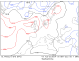
Click here for details of the weather over the next few days.
Please note that forecasting beyond five days is notoriously difficult, and small errors at short-range can lead to large deviations further in time. Our longer-range forecasts are based on the most accurate weather data available at the time, but alterations may be required as the period progresses. Please check back regularly for the most up-to-date forecast run.
Thursday 22/07/04 to Friday 23/07/04
England and Wales will have a small taste of summer on Thursday, as a ridge of high pressure and light southerly winds give a sunny, warm day across many parts. In south-east England, it will become very warm, although feeling rather humid. However, low pressure out to the west will slowly move in during the day, giving increased cloud across Ireland, Northern Ireland and much of Scotland. Together with freshening south-westerly winds, bursts of rain will move in here later, some heavy over the hills. On Friday, the humid conditions across much of central and eastern England will persist, but with more cloud around. This cloud will threaten scattered heavy showers, perhaps with thunder. Scotland and Northern Ireland will become dry with sunny spells, once any lingering thundery rain clears from eastern Scotland. Apart from one or two light showers, Ireland and Wales will have a fresher, but brighter day with plenty of sunshine.
 Saturday 24/07/04 to Sunday 25/07/04
With high pressure to the west, and low pressure to the east, a northerly wind will develop on Saturday. However, this will not be a cold wind, as much of the UK will be fresher, but still pleasantly warm. Indeed, some southern parts of England, Wales and Ireland may become very warm with plenty of sunshine. Everywhere will be dry, with the exception of eastern England where there will be a few showers, perhaps heavy and thundery in south-eastern parts. The high pressure out to the west will strengthen on Sunday, giving mostly fine and settled weather across much of the UK and Ireland. Once again, the warmest temperatures, into the mid-twenties Celsius, will be across south-west England, south Wales and southern parts of Ireland. A light easterly breeze may blow more cloud onto the coast of East Anglia and Lincolnshire, and during the afternoon a few sharp showers will develop over the Scottish uplands.
 Monday 26/07/04 to Wednesday 28/07/04
On Monday, the high pressure will remain in place, but will slowly begin to decline. For most of the country, it will remain settled, sunny and warm, but cloud and patchy rain will topple southwards across eastern parts of the country during the afternoon. By Tuesday, the sunshine will be clinging on for dear life as thicker cloud in the west threatens rain for Ireland, showers develop across north-west Scotland, and scattered thunderstorms drift into south-east England. Elsewhere, it should remain dry and sunny. Showers will develop country-wide on Wednesday, with more persistent rain across Ireland and Northern Ireland. As ever, please check back for further forecast updates.