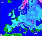
Long-range Outlook: 24/01/05 - 29/01/05
A battle between mild and cold.
Click here for details of the weather over the next few days.
Please note that forecasting beyond five days is notoriously difficult, and small errors at short-range can lead to large deviations further in time. Our longer-range forecasts are based on the most accurate weather data available at the time, but alterations may be required as the period progresses. Please check back regularly for the most up-to-date forecast run.
Monday 24/01/05 to Tuesday 25/01/05
A cold and frosty start is expected on Monday, but there will be plenty of winter sunshine. Ireland and Northern Ireland will remain dry and sunny all day with light winds. Wales, western Scotland and western parts of England will also be dry and bright, if cold. However, for eastern Scotland, eastern England and the east Midlands, brisk northerly winds will blow in plenty of snow showers, giving a covering almost anywhere. Most at risk from snow cover will be East Anglia and south-east England through the afternoon. The cold and wintry weather is set to remain in south-east England on Tuesday, with a few snow showers continuing. Elsewhere, with high pressure toppling eastwards, winds will gradually begin to switch to the north-west, bringing in milder air. However, as the air moves across Northern Ireland, Scotland and northern England, patchy rain will turn to light snow for a time, and there could be a problem with freezing rain in the east.
 Wednesday 26/01/05 to Thursday 27/01/05
The return to milder weather on Wednesday will still remain on a knife-edge, and for south-east England it's likely to remain cold and crisp. Elsewhere across the UK and Ireland, there will be a lot of cloud, with patchy drizzle almost anywhere. It will be much milder though, although where the cloud has broken overnight, there could be a few patches of frost first thing. Winds will be generally light, and north-westerly in direction. By Thursday, it does look as if the milder air will win, as high pressure continues to push eastwards across the UK. There will be some sunny spells around, particularly across Ireland, south-west England and south Wales. Elsewhere, there will be plenty of cloud with outbreaks of light rain and drizzle. Most of the rain will be across northern and western hills in both Scotland and Northern Ireland, with many other parts of England and Wales remaining dry. Although milder, there could be patchy frost overnight.
 Friday 28/01/05 to Saturday 29/01/05
On Friday, early frost and patchy fog will soon clear across England, Wales and Ireland, leaving a dry day with some bright or sunny spells. Scotland and Northern Ireland may start dry and bright, but it won't take long for thickening cloud to bring outbreaks of rain from the north-west, becoming heavier later over the hills. Mild in the north, but beginning to feel chilly in the south again. Confidence is currently very low for the weekend, but it does look as if colder air is going to try and build back from the north. Much of the UK will have rain at times, and through the afternoon this could turn to snow across Scotland as winds become more northerly. As ever, please check back for further forecast updates.